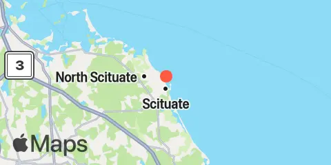
Latitude
42° 12' 6" N (42.2017)
Longitude
70° 43' 36" W (-70.7267)
State
County
Nearest ZIP
02066
Nearby
Tides
2.9 mi
Damons Point, North River
4.4 mi
Cohasset Harbor (White Head)
8.3 mi
Nantasket Beach, Weir River
8.7 mi
Hingham
9.2 mi
Brant Rock, Green Harbor River
9.5 mi
Crow Point, Hingham Harbor entrance
11.7 mi
Duxbury, Duxbury Harbor, Cape Cod Bay
12.1 mi
Hull
12.2 mi
Boston Light, Boston Harbor
Currents
9.4 mi
Weir River entrance
9.7 mi
Crow Point, 0.2 n.mi. north of
10.0 mi
Thieves Ledge
10.7 mi
Bumkin Island, 0.1 n.mi. west of
10.9 mi
Stodders Neck, Weymouth Back River
11.0 mi
Bumkin Island, 0.4 n.mi. west of
11.0 mi
Little Brewster Island, 1.5 n.mi. E of
11.0 mi
Grape Island and Lower Neck, between
11.3 mi
Point Allerton, 0.4 n.mi. northwest of
11.4 mi
Grape Island
11.6 mi
Point Allerton, 0.65 n.mi. NNW of
11.6 mi
Windmill Point, 0.7 n.mi. SSE of
11.7 mi
Jacknife Ledge
11.8 mi
Gull Point, 0.4 n.mi. ESE of
11.9 mi
The Piglets, 0.4 n.mi. northest of
11.9 mi
Sheep Island, 0.3 n.mi. west of
12.0 mi
Boston Light, 0.2 n.mi. south of
12.3 mi
Pig Rock, north of
12.3 mi
Pig Rock, northwest of
12.3 mi
Hull Gut
12.4 mi
Weymouth Harbor Entrance
