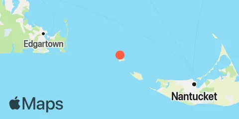
Latitude
41° 20' 12" N (41.3367)
Longitude
70° 18' 18" W (-70.305)
State
County
Nearest ZIP
02554
Nearby
Tides
5.9 mi
Eel Point, Nantucket Island
7.7 mi
Wasque Point, Chappaquiddick Island, Martha's Vineyard
11.3 mi
Edgartown, Martha's Vineyard
11.4 mi
Nantucket, Nantucket Island
Currents
1.4 mi
Muskeget I., channel 1 mile northeast of
4.7 mi
Muskeget Rock, 1.3 miles southwest of
5.2 mi
Long Shoal-Norton Shoal, between
6.0 mi
Muskeget Channel
7.1 mi
Eel Pt., Nantucket I. 2.5 miles NE of
7.7 mi
Cape Poge Lt., 1.7 miles SSE of
7.7 mi
Tuckernuck Island, 4.2 miles SSW of
7.8 mi
Cross Rip Channel
8.3 mi
Tuckernuck Shoal, off east end
9.7 mi
Cape Poge Lt., 3.2 miles northeast of
10.6 mi
Great Point, 3 miles west of
10.8 mi
Nantucket Harbor entrance channel
11.1 mi
Cape Poge Light, 1.4 miles west of
11.7 mi
Halfmoon Shoal, 1.9 miles northeast of
12.0 mi
Halfmoon Shoal, 3.5 miles east of
