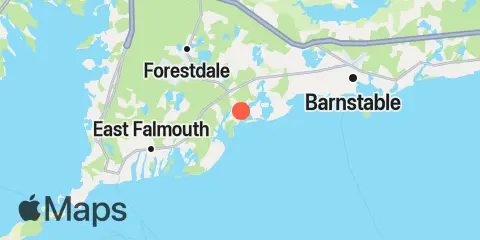
Latitude
41° 36' 30" N (41.6083)
Longitude
70° 26' 12" W (-70.4367)
State
County
Nearest ZIP
02635
Nearby
Tides
2.0 mi
Poponesset Island, Poponesset Bay, Nantucket Sound
7.2 mi
Hyannis Port, Nantucket Sound
9.2 mi
Falmouth Heights, Nantucket Sound
11.1 mi
Barnstable Harbor, Beach Point, Cape Cod Bay
11.1 mi
Chapoquoit Point, West Falmouth Harbor, Buzzards Bay
11.9 mi
Cape Cod Canal, Sandwich, Cape Cod Bay
11.9 mi
Monument Beach, Buzzards Bay
12.0 mi
Oak Bluffs, Martha's Vineyard
Currents
0.4 mi
Cotuit Bay entrance (Bluff Point)
5.2 mi
Wreck Shoal-Eldridge Shoal, between
6.4 mi
Waquoit Bay entrance
8.6 mi
Lewis Bay entrance channel
8.8 mi
Hedge Fence-L'Hommedieu Shoal, between
8.8 mi
Broken Ground-Horseshoe Shoal, between
9.2 mi
L'Hommedieu Shoal, north of west end
9.4 mi
Point Gammon, 1.2 miles south of
9.8 mi
Hedge Fence Lighted Gong Buoy 22
10.5 mi
Cape Poge Lt., 3.2 miles northeast of
10.6 mi
East Chop, 1 mile north of
11.2 mi
East Chop-Squash Meadow, between
11.3 mi
Nobska Point, 1.8 miles east of
11.4 mi
West Chop, 0.8 mile north of
11.8 mi
Barnstable Harbor
12.0 mi
Cape Cod Canal, east end
12.4 mi
Bourne Highway bridge
