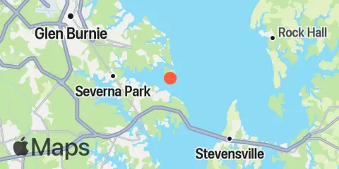
Mountain Point Map
Latitude
39° 3' 42" N (39.0617)
Longitude
76° 25' 60" W (-76.4333)
State
County
Nearest ZIP
21012
Nearby
Tides
2.7 mi
Cornfield Creek, Magothy River, Chesapeake Bay
5.9 mi
Brewer Point, Severn River
6.0 mi
Annapolis (US Naval Academy), Severn River
7.4 mi
Love Point, Chester River
8.4 mi
Matapeake, Kent Island, Chesapeake Bay
8.6 mi
Stony Creek, Patapsco River
9.4 mi
North Point, Patapsco River
9.7 mi
Gingerville Creek, South River, Chesapeake Bay
9.9 mi
Edgewater, South River, Chesapeake Bay
10.9 mi
Deep Landing, Swan Creek, Chesapeake Bay
11.2 mi
Thomas Point Shoal Light, Chesapeake Bay
11.5 mi
Hawkins Point, Patapsco River
12.1 mi
Kent Island Narrows, Chesapeake Bay
Currents
0.3 mi
Mountain Point, Magothy River entrance
2.5 mi
Craighill Channel, NE of Mountain Pt
3.1 mi
Craighill Channel, Belvidere Shoal
3.3 mi
Craighill Channel entrance, Buoy '2C'
4.9 mi
Baltimore Harbor Approach (off Sandy Point)
4.9 mi
Sandy Point, 0.8 n.mi. ESE of
5.2 mi
Craighill Angle, right outside quarter
5.5 mi
Chesapeake Bay Bridge, main channel
6.1 mi
Sandy Point, 2.3 n.mi. east of
6.1 mi
Chesapeake Bay Bridge, 0.5nm S of (LB91)
6.2 mi
Greenbury Point, 1.8 miles east of
6.6 mi
Love Point, 2.5 miles north of
7.0 mi
Love Point, 2.0 nmi north of
7.4 mi
Brewerton Channel Eastern Ext., Buoy '7'
7.6 mi
Swan Point, 2.7 n.mi. SW of
7.8 mi
Swan Point, 2.6 n.mi. west of
8.8 mi
Tolly Point, 1.6 miles east of
9.1 mi
Love Point, 1.6 n.mi. east of
9.8 mi
Swan Point, 1.6 miles northwest of
10.8 mi
North Point, 2.5 miles northeast of
11.7 mi
Tolchester Channel, SW of Bouy '58B'
11.7 mi
Thomas Pt. Shoal Lt., 2.0 n.mi. east of
11.8 mi
Thomas Pt. Shoal Lt., 0.5 n.mi. SE of
11.8 mi
Kent Island Narrows (highway bridge)
12.0 mi
Tolchester Channel, south of Buoy '38B'