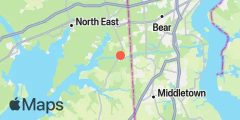
Latitude
39° 31' 36" N (39.5267)
Longitude
75° 48' 36" W (-75.81)
State
County
Nearest ZIP
21915
Nearby
Tides
3.8 mi
Old Frenchtown Wharf, Elk River
4.1 mi
Summit Bridge, Chesapeake and Delaware Canal
5.9 mi
Town Point Wharf, Elk River
8.8 mi
St. Georges, Chesapeake and Delaware Canal
9.1 mi
Charlestown, Northeast River, Chesapeake Bay
12.1 mi
Delaware City Branch Channel bridge, Delaware River
12.4 mi
Delaware City, Delaware River
Currents
0.2 mi
Chesapeake City Bridge, 0.45 n.mi. E of
1.0 mi
Chesapeake and Delaware Canal, Chesapeake City
3.0 mi
Back Creek, 0.3 n.mi. W of Sandy Pt
3.2 mi
Hendersons Point
5.8 mi
Conrail Bridge, east of
6.0 mi
Old Town Point Wharf, northwest of
8.7 mi
St. George Bridge, 0.1 n.mi. ENE of
9.3 mi
Red Point, 0.2 mile W of, Northeast River
9.8 mi
Arnold Point, 0.4 mile west of
10.3 mi
Rocky Pt. (Elk Neck), 0.25 n.mi. SW of
12.1 mi
Georgetown
