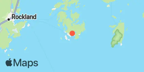
TidesPro
  • Recents
    • Vinalhaven, Vinalhaven Island, Penobscot Bay
  • Tides
    United States
    Alabama Alaska California Connecticut Delaware District of Columbia Florida Georgia Hawaii
    Louisiana Maine Maryland Massachusetts Mississippi New Hampshire New Jersey New York North Carolina
    Oregon Pennsylvania Rhode Island South Carolina Texas US Outlying Islands Virginia Washington Puerto Rico
    Caribbean
    The Bahamas Cayman Islands Cuba Dominican Republic Haiti Jamaica Virgin Islands (US)
  • Fishing  Coordinates
    Alabama - Alabama Inshore Public Reefs Alabama - Alabama Nearshore Public Reefs Alabama - Alabama Offshore Public Reefs California - California Artificial Reefs Delaware - Delaware Artificial Reefs Florida - Bay County Florida - Brevard County Florida - Broward County Florida - Charlote and Lee Counties Florida - Citrus County Florida - Collier County Florida - Dixie County Florida - Duval County Florida - Escambia County Florida - Flagler County Florida - Florida Keys Florida - Franklin County Florida - Gulf County Florida - Hernando County
    Florida - Indian River County Florida - Levy County Florida - Manatee County Florida - Martin County Florida - Miami-Dade County Florida - Monroe County Florida - Nassau County Florida - Okaloosa County Florida - Palm Beach County Florida - Pasco County Florida - Santa Rosa County Florida - Sarasota County Florida - St. Johns County Florida - St. Lucie County Florida - Tampa Bay Florida - Taylor County Florida - Volusia County Florida - Wakulla County Florida - Walton County
    Georgia - Georgia Reefs Hawaii - Hawaii Artificial Reefs Louisiana - Louisiana Artificial Reefs Maryland - Maryland Artificial Reefs Massachusetts - Massachusetts Artificial Reefs Mississippi - Mississippi Inshore Artificial Reefs Mississippi - Mississippi Offshore Artificial Reefs New Jersey - New Jersey Artificial Reefs New York - New York Artificial Reefs North Carolina - Estuarine North Carolina - Long Bay North Carolina - Onslow Bay North Carolina - Outer Banks North Carolina - Raleigh Bay Puerto Rico - Puerto Rico Artificial Reefs Rhode Island - Rhode Island Artificial Reefs South Carolina - South Carolina Reefs Texas - Texas Artificial Reefs Virginia - Virginia Artificial Reefs
  • Solunar Tables
Vinalhaven Location
  1. United States
  2. Maine
  3. Vinalhaven, Vinalhaven Island, Penobscot Bay

Vinalhaven Map

Day Week Month Table Month Chart Map
Latitude
44° 2' 36" N (44.0433)
Longitude
68° 50' 24" W (-68.84)
State
Maine
County
Knox County
Nearest ZIP
04863
Nearby
Tides 6.0 mi North Haven, Penobscot Bay 8.2 mi Pulpit Harbor, North Haven Island, Penobscot Bay 10.3 mi Isle Au Haut, Penobscot Bay 11.7 mi Stonington, Deer Isle, Penobscot Bay Currents 1.0 mi The Reach, NNE of, Green Island 1.9 mi Heron Neck, Green Island 3.0 mi Laireys Island, south of 3.2 mi Leadbetter Island, E of southern tip 3.3 mi White Islands, northeast of 3.4 mi Leadbetter I., SSW of southern tip 3.5 mi Crotch Island, east of 4.1 mi Triangle Ledge, SSE of 4.1 mi Little Hurricane Island, southwest of 4.5 mi Leadbetter Island, northwest tip of 5.0 mi Dogfish Island, NNE of 6.0 mi Browns Head, Vinalhaven Island, NNW of 6.2 mi Widow Island-Stimpson Island, between 6.4 mi Fox Island Thorofare 6.5 mi Crabtree Pt., North Haven I., NNE of 7.3 mi Moore Harbor, W of 9.2 mi Andrews Island, ESE of 9.4 mi Mark Island, north of 10.2 mi Fisherman Island Passage 10.3 mi Burnt Island-Oak Island, between 10.5 mi Dodge Point-Monroe Island, between 10.8 mi Eagle Island, 0.4 nautical mile S of 10.9 mi Sheep Island 11.0 mi Mark Island, 0.3 nmi., SSE of 11.1 mi Saddle Island, northwest of 11.2 mi Lasell Island, SSW of 11.9 mi East Goose Rock, NNE of 12.0 mi Compass Island, 0.4 nmi. ENE of 12.2 mi Russ Island, N of, Deer Island Thorofare 12.4 mi Scrag Island, 0.3 nautical mile SW of

About

TidesPro was created as an easy-to-use tides and solunar site. It provides tide predictions and marine weather for many types of people, whether you’re fishing, going to the beach, boating, kayaking, surfing, or planning a trip. With anglers in mind, it also provides an accessible way to find fishing spots and the best times to fish in those locations.

More About TidesPro

App

Apple App Store
[More Info]
Quick Links
  • When to Fish
  • Solunar Theory
  • Tide & Solunar Widgets for Your Site
  • Tide & Solunar Predictions in Google Earth
  • Things to Do
  • About

© Copyright 2017 - 2025 ASR Concepts LLC. All rights reserved.

  • Privacy Policy
  • •
  • Terms of Use
  • •
  • Contact
  • •
  • Bluesky
  • •
  • Mastodon