Prince Point Weekly Tide Tables and Charts
Tide Chart for Next 7 Days
Prince Point weekly tide chart key:
The tide chart above shows the times and heights of high tide and low tide for Prince Point, for the next seven days. The red line highlights the current time and estimated height.The tidal range at Prince Point for the next seven days is approximately 9.76 ft with a minimum tide of -0.06 ft and maximum tide of 9.7 ft. You can also check out all the daily details on tides & fishing times on the Day tab for Prince Point.
Tide Table for Next 7 Days
▲ Blue = High Tide
▼ Red = Low Tide
| Day | 1st Tide | 2nd Tide | 3rd Tide | 4th Tide | ☀ Sun |
Major Solunars
|
Minor Solunars
|
|
|---|---|---|---|---|---|---|---|---|
| 12 Wed |
|
4:40 AM ▼ 0.61 ft |
10:52 AM ▲ 9.68 ft |
5:12 PM ▼ -0.06 ft |
11:22 PM ▲ 9.11 ft |
▲ 6:58 AM ▼ 6:44 PM |
11:50 AM → 1:50 PM |
6:27 AM → 7:27 AM 5:14 PM → 6:14 PM |
| 13 Thu |
|
5:24 AM ▼ 0.36 ft |
11:36 AM ▲ 9.7 ft |
5:51 PM ▼ -0.05 ft |
▲ 6:56 AM ▼ 6:45 PM |
12:06 AM → 2:06 AM 12:32 PM → 2:32 PM |
6:46 AM → 7:46 AM 6:18 PM → 7:18 PM |
|
| 14 Fri |
|
12:01 AM ▲ 9.32 ft |
6:05 AM ▼ 0.19 ft |
12:16 PM ▲ 9.62 ft |
6:26 PM ▼ 0.06 ft |
▲ 6:54 AM ▼ 6:46 PM |
12:47 AM → 2:47 AM 1:12 PM → 3:12 PM |
7:03 AM → 8:03 AM 7:21 PM → 8:21 PM |
| 15 Sat |
|
12:35 AM ▲ 9.46 ft |
6:42 AM ▼ 0.11 ft |
12:53 PM ▲ 9.43 ft |
6:58 PM ▼ 0.26 ft |
▲ 6:52 AM ▼ 6:47 PM |
1:26 AM → 3:26 AM 1:51 PM → 3:51 PM |
7:19 AM → 8:19 AM 8:24 PM → 9:24 PM |
| 16 Sun |
|
1:07 AM ▲ 9.5 ft |
7:18 AM ▼ 0.12 ft |
1:28 PM ▲ 9.18 ft |
7:29 PM ▼ 0.51 ft |
▲ 6:51 AM ▼ 6:49 PM |
2:06 AM → 4:06 AM 2:32 PM → 4:32 PM |
7:36 AM → 8:36 AM 9:29 PM → 10:29 PM |
| 17 Mon |
|
1:39 AM ▲ 9.45 ft |
7:52 AM ▼ 0.22 ft |
2:03 PM ▲ 8.86 ft |
8:01 PM ▼ 0.82 ft |
▲ 6:49 AM ▼ 6:50 PM |
2:46 AM → 4:46 AM 3:14 PM → 5:14 PM |
7:55 AM → 8:55 AM 10:33 PM → 11:33 PM |
| 18 Tue |
|
2:11 AM ▲ 9.32 ft |
8:28 AM ▼ 0.4 ft |
2:40 PM ▲ 8.5 ft |
8:35 PM ▼ 1.15 ft |
▲ 6:47 AM ▼ 6:51 PM |
3:29 AM → 5:29 AM 3:57 PM → 5:57 PM |
8:16 AM → 9:16 AM 11:39 PM → 12:39 AM |
Current Weather
Air Temperature
35.8° F
Water Temperature
37.6° F
Wind
4.1 knots N (10°)
Wind Gust
7 knots
Atmospheric Pressure
30.1 in
Note: Observations are from a weather buoy 8.16 miles from the prediction site. Observations are not available at all prediction sites, and the number/type of observations varies between sites.
More details: Station casm1 Buoy Weather
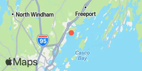
Location & Map
Latitude
43° 45' 42" N (43.7617)
Longitude
70° 10' 24" W (-70.1733)
State
County
Nearest ZIP
04096
Nearby
Tides
1.8 mi
Doyle Point, Casco Bay
2.6 mi
Falmouth Foreside, Casco Bay
3.2 mi
Great Chebeague Island, Casco Bay
5.0 mi
Long Island, Casco Bay
5.0 mi
Cow Island, Casco Bay
5.3 mi
South Freeport, Casco Bay
5.6 mi
Cliff Island, Luckse Sound, Casco Bay
5.9 mi
Vaill Island, Casco Bay
6.4 mi
Presumpscot River Bridge, Casco Bay
6.5 mi
Great Diamond Island, Casco Bay
7.2 mi
Back Cove, Casco Bay
7.5 mi
Peaks Island, Casco Bay
7.7 mi
South Harpswell, Potts Harbor, Casco Bay
8.0 mi
Portland, Casco Bay
8.2 mi
Cushing Island, Casco Bay
9.7 mi
Portland Head Light, Casco Bay
10.0 mi
Fore River, Casco Bay
10.7 mi
Wilson Cove, Middle Bay, Casco Bay
Currents
2.3 mi
Littlejohn Island, South of Town Ledge
4.2 mi
Long Island, Mariner Ledge
4.3 mi
Chandler Cove, S. Ent
4.7 mi
Cow Island, NE of
5.0 mi
Hussey Sound, Cow Island
5.0 mi
Stepping Stones
5.2 mi
Lucksee Sound Between Hope and Cliff Is.
6.3 mi
Hussey Sound, Between Long and Peaks Island
6.6 mi
Eagle Island W. of., Broad Sound
7.2 mi
Diamond Island Roads
7.7 mi
Ocean Gate Terminal
7.8 mi
Portland Breakwater Light, 0.3 n.mi east of
7.9 mi
Spring Point, NE of
8.2 mi
State Pier, Portland Harbor
9.0 mi
Fore River, Portland River Bridge
9.4 mi
Portland Harbor Entrance
Note: Tide predictions are an estimate and NOT FOR NAVIGATION.
We also offer free widgets if you want to add tide or solunar tables to your own site.