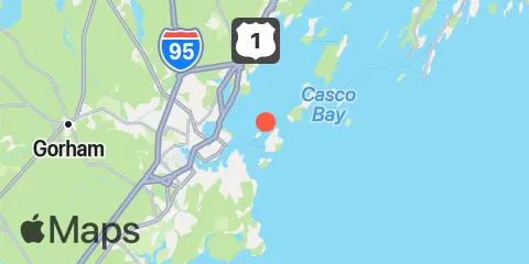
Latitude
43° 40' 12" N (43.67)
Longitude
70° 12' 0" W (-70.2)
State
County
Nearest ZIP
04109
Nearby
Tides
1.0 mi
Peaks Island, Casco Bay
1.5 mi
Cow Island, Casco Bay
1.7 mi
Cushing Island, Casco Bay
2.0 mi
Long Island, Casco Bay
2.3 mi
Vaill Island, Casco Bay
2.4 mi
Portland, Casco Bay
2.6 mi
Presumpscot River Bridge, Casco Bay
2.8 mi
Back Cove, Casco Bay
3.2 mi
Portland Head Light, Casco Bay
4.3 mi
Falmouth Foreside, Casco Bay
4.6 mi
Great Chebeague Island, Casco Bay
4.7 mi
Fore River, Casco Bay
4.8 mi
Cliff Island, Luckse Sound, Casco Bay
6.4 mi
Doyle Point, Casco Bay
6.5 mi
Prince Point, Casco Bay
10.0 mi
South Harpswell, Potts Harbor, Casco Bay
10.9 mi
Pine Point
11.4 mi
South Freeport, Casco Bay
Currents
0.9 mi
Diamond Island Roads
1.2 mi
Hussey Sound, Between Long and Peaks Island
1.6 mi
Spring Point, NE of
1.7 mi
Portland Breakwater Light, 0.3 n.mi east of
1.7 mi
Hussey Sound, Cow Island
1.9 mi
Cow Island, NE of
2.1 mi
Ocean Gate Terminal
2.5 mi
State Pier, Portland Harbor
2.8 mi
Long Island, Mariner Ledge
2.9 mi
Portland Harbor Entrance
3.3 mi
Fore River, Portland River Bridge
3.8 mi
Stepping Stones
4.2 mi
Chandler Cove, S. Ent
4.7 mi
Lucksee Sound Between Hope and Cliff Is.
6.9 mi
Littlejohn Island, South of Town Ledge
7.4 mi
Eagle Island W. of., Broad Sound
8.2 mi
Seal Cove, Cape Elizabeth
