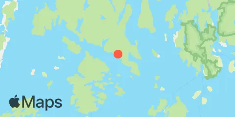
Latitude
44° 15' 48" N (44.2633)
Longitude
68° 35' 12" W (-68.5867)
State
County
Nearest ZIP
04616
Nearby
Tides
5.2 mi
Oceanville, Deer Isle, Penobscot Bay
5.6 mi
Little Deer Isle, Eggemoggin Reach
8.5 mi
Stonington, Deer Isle, Penobscot Bay
9.9 mi
Mackerel Cove, Swans Island, Blue Hill Bay
10.1 mi
Blue Hill Harbor, Blue Hill Bay
10.6 mi
Burnt Coat Harbor, Swans Island
11.7 mi
Bass Harbor, Mount Desert Island
Currents
6.9 mi
Little Deer I.-Sheep I., between
6.9 mi
Clam I., NW of, Deer I. Thorofare
7.2 mi
Little Eaton Island, NNE of
7.2 mi
Grog Island, E of, Deer Island Thorofare
7.3 mi
Swains Ledge, 0.3 nautical mile SW of
7.6 mi
Bradbury Island, ESE of
7.7 mi
Casco Passage, east end, Blue Hill Bay
8.2 mi
Russ Island, N of, Deer Island Thorofare
8.4 mi
Pumpkin Island, north of
8.4 mi
Pickering Island, south of
8.8 mi
Birch Island, northwest of
9.7 mi
Hog Island, ESE of
9.9 mi
Butter I., 0.3 nautical mile SE of
10.1 mi
Hat Island, SE of, Jericho Bay
10.5 mi
Mark Island, north of
10.8 mi
Eagle Island, 0.4 nautical mile S of
11.6 mi
Pond Island-Western Island, between
