Unfortunately, this tide station is no longer active, and predictions are no longer accurate.
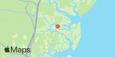
You can check out the map below -- any nearby locations will be displayed on the map and list below. Alternatively, you can browse the site for other active locations.
Location & Map
Latitude
31° 40' 0" N (31.66667)
Longitude
81° 16' 0" W (-81.26667)
State
County
Nearest ZIP
31331
Nearby
Tides
0.0 mi
North Newport River
1.7 mi
Thomas Landing, S. Newport River
2.0 mi
Halfmoon, Timmons River
2.5 mi
Eagle Neck, South Newport River
3.0 mi
Harris Neck, Barbour Island River
4.5 mi
North Newport River (Daymark 119)
6.3 mi
Barbour Island, Barbour Island River
6.5 mi
Dallas Bluff, Julienton River
6.8 mi
Walburg Creek entrance
7.0 mi
Sunbury, Sunbury Channel
7.8 mi
South Newport River (Daymark 135)
8.3 mi
South Ossabaw Island, Bear River
9.2 mi
Kilkenny Club, Kilkenny Creek
9.3 mi
Dog Hammock, Sapelo River
10.0 mi
Blackbeard Island
10.1 mi
Bear River, (Range 'A' Light)
10.3 mi
Pine Harbor, Sapelo River
10.8 mi
Bellville Point, Sapelo River
10.9 mi
Eagle Creek, Mud River
10.9 mi
Belfast, Belfast River
11.9 mi
Florida Passage, Bear River
12.1 mi
Creighton Narrows entrance, Crescent River
Currents
0.2 mi
N. Newport River, ESE of S. Newport Cut
2.4 mi
S. Newport River, below S. Newport Cut
3.3 mi
N. Newport River, NW of Johnson Creek
4.1 mi
S. Newport River, above Swain River Ent
4.2 mi
N. Newport River, above Walburg Creek
5.0 mi
N. Newport River, NE of Vandyke Creek
5.4 mi
Johnson Creek, midway between ends
5.6 mi
Medway River, northwest of Cedar Point
6.0 mi
Medway River at Marsh Island
8.1 mi
St. Catherines Sound Entrance
8.2 mi
Northwest of Newell Creek Entrance
8.4 mi
South of Kilkenny Creek Entrance
8.5 mi
Cedar Hammock, south of
9.1 mi
Sutherland Bluff, Sapelo River
9.1 mi
Sapelo River Entrance
10.1 mi
Entrance
10.2 mi
North of Big Tom Creek Entrance
10.8 mi
Front River
11.3 mi
610 Statute Mile Mark
11.8 mi
New Teakettle Cr., 0.8 mi. N of
