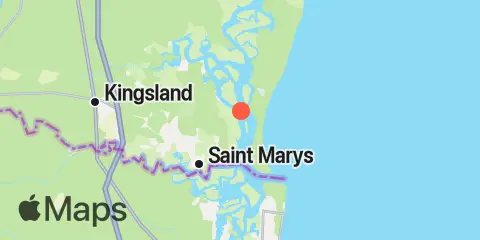
Nearby
Tides
1.6 mi
Dungeness, Seacamp Dock
1.9 mi
Kings Bay, Navy Base
3.7 mi
Beach Creek ent., Cumberland Island
4.5 mi
Crooked River, Cumberland Dividings
4.9 mi
St. Marys Entrance, North Jetty
5.1 mi
Cut 1N front range, St. Marys River
5.3 mi
St. Marys, St. Marys River
7.0 mi
Chester, Bells River
7.2 mi
Roses Bluff, Bells River
7.5 mi
Fernandina Beach, Amelia River
8.4 mi
Harrietts Bluff, Crooked River
8.7 mi
Crandall, St. Marys River
9.5 mi
Lofton, Lanceford Creek
10.2 mi
Kingsley Creek, RR. bridge
10.8 mi
Cumberland Wharf, Cumberland River
11.0 mi
Floyd Creek, 2.8 miles above entrance
11.4 mi
Vaughns Landing
Currents
0.3 mi
Range E, LB 43, Cumberland Sound
0.8 mi
Kings Bay, Site VI
1.4 mi
Drum Point Island, Range D Channel
2.2 mi
Stafford Island, west of
2.8 mi
Kings Bay, North Turning Basin
3.7 mi
Range A2, LB 29, Cumberland Sound
4.9 mi
Fort Clinch, 1.1 n.mi. NW of
5.1 mi
Range A, LB 23, St Marys River
5.4 mi
Quarantine Reach, 0.4nm W of Fort Clinch
5.6 mi
St. Mary's River Entrance
6.6 mi
St Marys Entrance, LB 19
6.6 mi
Old Fernandina, Amelia River, Old Town Reach
7.3 mi
Cabin Bluff, Cumberland River
7.4 mi
south jetty
7.6 mi
Fernandina Beach, City Front Reach, Amelia River
8.5 mi
St Marys Entrance, LB 13
10.4 mi
Kingsley Creek, highway bridge
