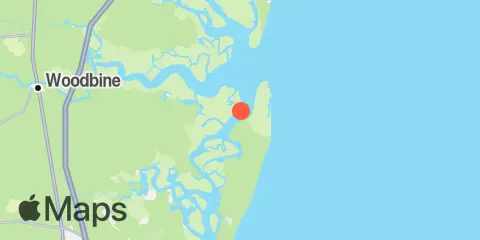
Latitude
30° 55' 48" N (30.93)
Longitude
81° 26' 48" W (-81.4467)
State
County
Nearest ZIP
31558
Nearby
Tides
3.6 mi
Floyd Creek, 2.8 miles above entrance
5.2 mi
Todd Creek entrance, Satilla River
5.9 mi
Raccoon Key Spit, St. Andrew Sound
6.4 mi
Crooked River, Cumberland Dividings
7.7 mi
Dover Bluff, Dover Creek
8.9 mi
Jekyll Island Marina, Jekyll Creek
9.2 mi
Harrietts Bluff, Crooked River
9.3 mi
2.5 miles above mouth, Little Satilla River
9.4 mi
Bailey Cut, 0.8 mile west of, Satilla River
10.1 mi
Kings Bay, Navy Base
10.8 mi
Kings Bay, MSF Pier, Cumberland Sound
11.6 mi
Dungeness, Seacamp Dock
11.9 mi
Jointer Island, Jointer Creek
Currents
2.2 mi
Cumberland River, north entrance
4.6 mi
Entrance
5.2 mi
Cabin Bluff, Cumberland River
7.3 mi
Jekyll Creek, south entrance
8.7 mi
Stafford Island, west of
9.4 mi
Kings Bay, North Turning Basin
10.2 mi
Kings Bay, Site VI
11.0 mi
Range E, LB 43, Cumberland Sound
12.0 mi
Drum Point Island, Range D Channel
