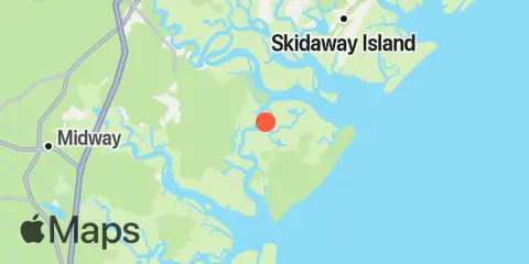
Latitude
31° 49' 0" N (31.81667)
Longitude
81° 9' 0" W (-81.15)
State
County
Nearest ZIP
31324
Nearby
Tides
1.0 mi
Florida Passage, Bear River
2.5 mi
Bear River, (Range 'A' Light)
2.5 mi
Florida Passage, Ogeechee River
3.7 mi
Kilkenny Club, Kilkenny Creek
4.1 mi
Egg Islands
5.9 mi
Bradley Point, Bradley River
6.0 mi
Fort McAllister, Ogeechee River
6.5 mi
South Ossabaw Island, Bear River
7.2 mi
Little Wassaw Island, Green Island Sound
8.1 mi
Coffee Bluff, Forest River
8.2 mi
Vernon View, Burnside River
8.3 mi
Sunbury, Sunbury Channel
8.7 mi
Belfast, Belfast River
8.8 mi
Walburg Creek entrance
9.7 mi
North Newport River (Daymark 119)
11.0 mi
Halfmoon, Timmons River
11.9 mi
Romerly Marsh Creek
12.0 mi
Richmond Hill, Ogeechee River
Currents
1.0 mi
Florida Passage (south)
1.6 mi
610 Statute Mile Mark
2.4 mi
North of Big Tom Creek Entrance
2.8 mi
Florida Passage, N of, Ogeechee River
4.3 mi
South of Kilkenny Creek Entrance
4.8 mi
Northwest of Newell Creek Entrance
5.2 mi
Raccoon Key & Egg Island Shoal, between
5.8 mi
Little Ogeechee River Entrance
5.8 mi
Little Don Island, east of, Vernon River
6.4 mi
Raccoon Key
6.4 mi
Little Ogeechee River Entrance, north of
6.4 mi
Vernon R., 1.2 miles S of Possum Point
6.5 mi
Medway River at Marsh Island
6.6 mi
Bradley Point, NNE of
6.9 mi
Little Wassaw Island, SW of
7.1 mi
St. Catherines Sound Entrance
7.5 mi
Medway River, northwest of Cedar Point
8.3 mi
Montgomery, Vernon River
8.3 mi
Burnside Island, SE of, Burnside River
8.8 mi
Wassaw Island, SSW of
8.9 mi
N. Newport River, NE of Vandyke Creek
9.3 mi
Pigeon Island, SSE of, Skidaway River
9.5 mi
Odingsell River Entrance
9.8 mi
Long Island, south of, Skidaway River
10.2 mi
N. Newport River, above Walburg Creek
10.7 mi
Skidaway Narrows
11.0 mi
Long Island, NNE of, Skidaway River
11.2 mi
N. Newport River, NW of Johnson Creek
11.9 mi
Burntpot Island, west of, Skidaway River
