Shield Point Tides & Fishing Times
Tides
Shield Point tide chart key:
The tide chart above shows the times and heights of high tide and low tide for Shield Point, as well as solunar period times (represented by fish icons). The red line highlights the current time and estimated height.| Day | Tide | Time | Height |
|---|---|---|---|
| 31 Mon | Low | 10:37 PM | -0.28 ft |
| 1 Tue | High | 2:00 PM | 1.88 ft |
| 2 Wed | Low | 1:08 AM | -0.35 ft |
Tuesday, April 1, 2025 10:09 PM: The tide is currently falling at Shield Point with a current estimated height of 0.0 ft. The last tide was High at 2:00 PM and the next tide is a Low of -0.35 ft at 1:08 AM.
Solunars & Sun/Moon Times
Waxing Crescent
 10%
10%
Moonrise
8:37 AM
Moonset
11:18 PM
Sunrise
6:37 AM
Sunset
7:07 PM
Current Weather
Air Temperature
71.8° F
Water Temperature
72.5° F
Wind
7 knots SSE (150°)
Wind Gust
9.9 knots
Atmospheric Pressure
29.97 in
Note: Observations are from a weather buoy 16.95 miles from the prediction site. Observations are not available at all prediction sites, and the number/type of observations varies between sites.
More details: Station pclf1 Buoy Weather
Next 7 Days
▲ Blue = High Tide
▼ Red = Low Tide
| Day | 1st Tide | 2nd Tide | 3rd Tide | 4th Tide | ☀ Sun |
Major Solunars
|
Minor Solunars
|
|
|---|---|---|---|---|---|---|---|---|
| 1 Tue |
|
2:00 PM ▲ 1.88 ft |
▲ 6:37 AM ▼ 7:07 PM |
3:21 AM → 5:21 AM 3:52 PM → 5:52 PM |
8:37 AM → 9:37 AM 11:18 PM → 12:18 AM |
|||
| 2 Wed |
|
1:08 AM ▼ -0.35 ft |
2:43 PM ▲ 1.97 ft |
▲ 6:35 AM ▼ 7:08 PM |
4:23 AM → 6:23 AM 4:54 PM → 6:54 PM |
9:28 AM → 10:28 AM |
||
| 3 Thu |
|
2:55 AM ▼ -0.41 ft |
3:35 PM ▲ 1.97 ft |
▲ 6:34 AM ▼ 7:09 PM |
5:26 AM → 7:26 AM 5:56 PM → 7:56 PM |
12:28 AM → 1:28 AM 10:25 AM → 11:25 AM |
||
| 4 Fri |
|
4:18 AM ▼ -0.44 ft |
4:39 PM ▲ 1.89 ft |
▲ 6:33 AM ▼ 7:09 PM |
6:28 AM → 8:28 AM 6:56 PM → 8:56 PM |
1:30 AM → 2:30 AM 11:27 AM → 12:27 PM |
||
| 5 Sat |
|
5:23 AM ▼ -0.42 ft |
5:46 PM ▲ 1.79 ft |
▲ 6:32 AM ▼ 7:10 PM |
7:28 AM → 9:28 AM 7:52 PM → 9:52 PM |
2:24 AM → 3:24 AM 12:32 PM → 1:32 PM |
||
| 6 Sun |
|
6:21 AM ▼ -0.32 ft |
6:41 PM ▲ 1.65 ft |
▲ 6:31 AM ▼ 7:10 PM |
8:22 AM → 10:22 AM 8:45 PM → 10:45 PM |
3:09 AM → 4:09 AM 1:36 PM → 2:36 PM |
||
| 7 Mon |
|
7:11 AM ▼ -0.15 ft |
7:27 PM ▲ 1.46 ft |
▲ 6:29 AM ▼ 7:11 PM |
9:12 AM → 11:12 AM 9:32 PM → 11:32 PM |
3:47 AM → 4:47 AM 2:37 PM → 3:37 PM |
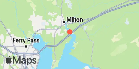
Location & Map
Latitude
30° 34' 54" N (30.5817)
Longitude
87° 0' 54" W (-87.015)
State
County
Nearest ZIP
32583
Nearby
Tides
0.9 mi
Bay Point, Blackwater River, Pensacola Bay
2.7 mi
Milton, Blackwater River, Pensacola Bay
3.9 mi
Hawkins Recreational Park, Blackwater River
9.8 mi
Floridatown, Escambia Bay
9.9 mi
Lora Point, Escambia Bay, Pensacola Bay
10.1 mi
Hernandez Point North
10.3 mi
Navarre, North Side
10.8 mi
East Bay, Pensacola Bay
Note: Tide predictions are an estimate and NOT FOR NAVIGATION.
We also offer free widgets if you want to add tide or solunar tables to your own site.