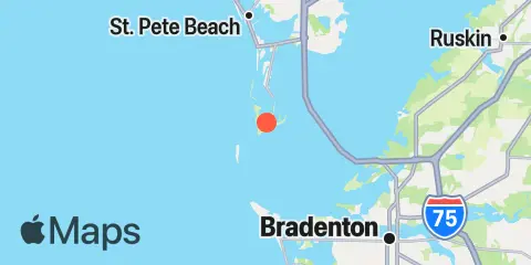
Latitude
27° 36' 54" N (27.615)
Longitude
82° 43' 36" W (-82.7267)
State
County
Nearest ZIP
33715
Nearby
Tides
2.2 mi
Egmont Key, Egmont Channel, Tampa Bay
4.7 mi
Pass-a-Grille Beach, Boca Ciega Bay
5.7 mi
Anna Maria Key, city pier
8.0 mi
Point Pinellas
8.2 mi
Anna Maria Key, Bradenton Beach
8.5 mi
Gulfport, Boca Ciega Bay
9.6 mi
Long Key, 0.5mi N. of Corey Causeway, Boca Ciega Bay
10.2 mi
Port Manatee, Tampa Bay
10.5 mi
Cortez, Sarasota Bay
11.8 mi
St. Petersburg, Tampa Bay
12.2 mi
Johns Pass, Boca Ciega Bay
12.3 mi
Bradenton, Manatee River
Currents
0.7 mi
Mullet Key Channel entrance
2.1 mi
Mullet Key Channel, marker '24'
2.2 mi
Tampa Bay Entrance (Egmont Channel)
2.3 mi
Bunces Pass (West of Bayway bridge)
4.4 mi
Sunshine Skyway Bridge
4.4 mi
Southwest Channel (S of Egmont Key)
4.9 mi
Pass-a-Grille Channel
4.9 mi
Rattlesnake Key, 3.1 miles west of
5.4 mi
Passage Key Inlet (off Bean Pt.)
5.4 mi
Pine Key (Pinellas Bayway bridge)
5.6 mi
Egmont Channel (3 mi. W of Egmont Key Lt.)
5.9 mi
Rattlesnake Key, 1.1 miles northwest of
6.1 mi
Pinellas Point, 2.6 miles south of
6.1 mi
Bridge, 0.8 mi. south of Maximo Pt.
6.2 mi
Joe Island, 1.8 miles northwest of
6.4 mi
Cut A & B, Channel Junction
6.5 mi
Cats Point (bridge west of)
8.1 mi
Pinellas Point, 0.5 mile southeast of
8.1 mi
Harbor Key, 1.3 miles west of
8.5 mi
Port Manatee Channel Entrance
8.6 mi
Pinellas Point, 1.9 miles SE of
8.7 mi
Egmont Channel, marker '10'
8.8 mi
Port Manatee Channel, marker '4'
10.0 mi
Blind Pass (north end)
10.2 mi
Cortez, north of bridge
10.4 mi
Lewis Island, 0.9 mile east of
10.4 mi
Piney Point, 0.6 mile NNW of
11.9 mi
Johns Pass Entrance
12.1 mi
Johns Pass Bridge, north span
12.2 mi
Longboat Pass
12.2 mi
Johns Pass Bridge, 0.3nm north of
