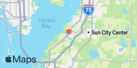
Latitude
27° 42' 18" N (27.705)
Longitude
82° 26' 54" W (-82.4483)
State
County
Nearest ZIP
33570
Nearby
Tides
2.1 mi
Shell Point
5.8 mi
Apollo Beach, Hillsborough Bay, Tampa Bay
6.0 mi
Newman Branch, Tampa Bay
8.4 mi
Port Manatee, Tampa Bay
11.6 mi
St. Petersburg, Tampa Bay
11.7 mi
Point Pinellas
12.3 mi
Port Tampa, Old Tampa Bay
Currents
5.5 mi
Cut E Channel, marker '2E'
6.2 mi
Camp Key, 1.9 miles northwest of
7.4 mi
Cut A Channel, marker '10', Hillsborough Bay
7.8 mi
Piney Point, 0.6 mile NNW of
9.4 mi
Port Manatee Channel, marker '4'
9.6 mi
Port Manatee Channel Entrance
9.8 mi
Snell Isle, 1.8 miles east of
9.8 mi
Cut C Channel, marker '21', Hillsborough Bay
10.0 mi
Lewis Island, 0.9 mile east of
10.0 mi
Pinellas Point, 1.9 miles SE of
11.1 mi
Harbor Key, 1.3 miles west of
11.3 mi
Pinellas Point, 0.5 mile southeast of
11.8 mi
Cut A & B, Channel Junction
11.9 mi
Ross Island, 1 mile east of, marker '4'
12.2 mi
Pinellas Point, 2.6 miles south of
