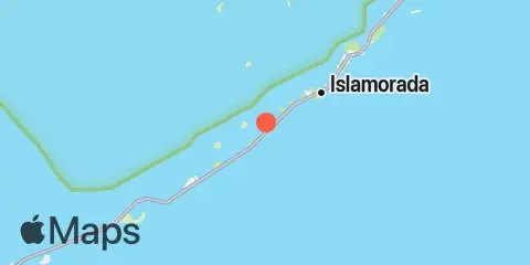
Latitude
24° 54' 54" N (24.915)
Longitude
80° 38' 24" W (-80.64)
State
County
Nearest ZIP
33036
Nearby
Tides
0.5 mi
Upper Matecumbe Key, Hawk Channel
0.9 mi
Islamorada, Upper Matecumbe Key, Florida Bay
1.3 mi
Shell Key Channel, Florida Bay
1.7 mi
Upper Matecumbe Key, west end, Hawk Channel
2.1 mi
Shell Key, northwest side, Lignumvitae Basin
2.5 mi
Whale Harbor Channel, Hwy. 1 bridge, Windley Key
2.6 mi
Whale Harbor, Windley Key, Hawk Channel
3.5 mi
Indian Key, Hawk Channel
3.5 mi
Lignumvitae Key, NE side, Florida Bay
4.1 mi
Snake Creek, Hwy. 1 bridge, Windley Key
4.2 mi
Lignumvitae Key, west side, Florida Bay
4.3 mi
Snake Creek, USCG Station, Plantation Key
4.7 mi
Alligator Reef, Hawk Channel
5.1 mi
Indian Key Anchorage, Lower Matecumbe Key
5.7 mi
Yacht Harbor, Cowpens Anchorage, Plantation Key
5.9 mi
Matecumbe Bight, Lower Matecumbe Key, Fla. Bay
6.0 mi
East Key, southern end, Florida Bay
6.4 mi
Crane Keys, north side, Florida Bay
6.9 mi
Plantation Key, Hawk Channel
7.6 mi
Matecumbe Harbor, Lower Matecumbe Key, Fla. Bay
8.3 mi
Channel Two, east, Lower Matecumbe Key, Fla. Bay
8.7 mi
Channel Two, west side, Hawk Channel
9.2 mi
Tavernier Creek, Hwy. 1 bridge, Hawk Channel
9.6 mi
Channel Five, East Side, Hawk Channel
9.9 mi
Tavernier Harbor, Hawk Channel
10.2 mi
Channel Five, west side, Hawk Channel
11.3 mi
Jewfish Hole, Long Key, Florida Bay
12.1 mi
Long Key Bight, Long Key
Currents
9.7 mi
Long Key, drawbridge east of
