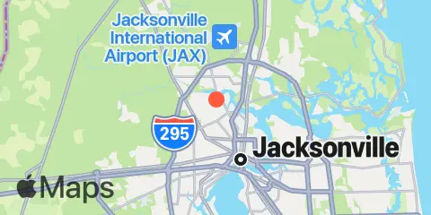
Latitude
30° 23' 54" N (30.3983)
Longitude
81° 41' 54" W (-81.6983)
State
County
Nearest ZIP
32208
Nearby
Tides
2.2 mi
Moncrief Creek entrance, Trout River
2.3 mi
Sherwood Forest, Trout River
3.8 mi
Phoenix Park
4.3 mi
Jacksonville, Navy Fuel Depot
4.3 mi
Cedar Heights, Broward River
5.4 mi
Jacksonville, Long Branch
5.9 mi
Main Street Bridge, St. Johns River
8.1 mi
Little Pottsburg Creek
8.3 mi
Ortega River entrance
8.4 mi
Dame Point, St. Johns River
9.2 mi
Blount Island Bridge
11.2 mi
Clapboard Creek, Pelotes Island
11.4 mi
Fulton
11.8 mi
Edwards Creek, Nassau River
11.8 mi
Mink Creek entrance, Nassau River
11.9 mi
Piney Point
Currents
4.3 mi
Trout River Cut
4.3 mi
Reddie Point
4.4 mi
Chaseville Turn
5.6 mi
Terminal Channel (north end)
5.6 mi
Acosta Bridge
5.7 mi
Drummond Point, channel south of
5.9 mi
Jacksonville, off Washington St
6.4 mi
Winter Point
7.0 mi
Commodore Point, terminal channel
8.4 mi
Dames Point Bridge
8.7 mi
Dames Point, 0.23 n.mi. ESE of
11.3 mi
Blount Island, East of
12.0 mi
St. Johns Bluff
