Unfortunately, this tide station is no longer active, and predictions are no longer accurate.
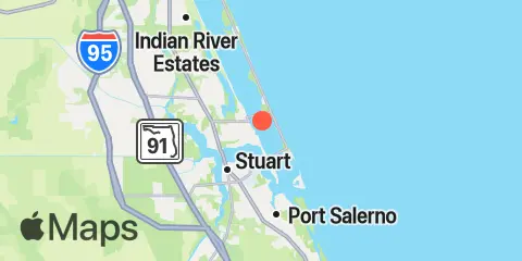
You can check out the map below -- any nearby locations will be displayed on the map and list below. Alternatively, you can browse the site for other active locations.
Location & Map
Latitude
27° 14' 6" N (27.235)
Longitude
80° 12' 36" W (-80.21)
State
County
Nearest ZIP
34957
Nearby
Tides
1.3 mi
Jensen Beach Causeway Park, ICWW
3.7 mi
Eden, Nettles Island, Indian River
3.8 mi
Stuart, St. Lucie River
4.4 mi
Sewall Point, St. Lucie River
4.8 mi
Seminole Shores
5.6 mi
South Fork, St. Lucie River
5.8 mi
Port Salerno, Manatee Pocket, St. Lucie River
6.0 mi
Great Pocket
6.2 mi
South Point, St. Lucie Inlet, St. Lucie River
6.4 mi
North Fork, St. Lucie River
9.2 mi
Ankona, Indian River
9.3 mi
Peck Lake, ICWW
10.8 mi
Gomez, South Jupiter Narrows
