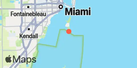
Latitude
25° 39' 6" N (25.6517)
Longitude
80° 9' 36" W (-80.16)
State
County
Nearest ZIP
33149
Nearby
Tides
3.3 mi
Key Biscayne Yacht Club, Biscayne Bay
4.3 mi
Soldier Key
5.5 mi
Virginia Key, Bear Cut, Biscayne Bay
7.1 mi
Dinner Key Marina, Biscayne Bay
7.9 mi
Government Cut, Miami Harbor Entrance
8.2 mi
Dodge Island, Fishermans Channel, Biscayne Bay
8.2 mi
Ragged Keys, Biscayne Bay
8.3 mi
Miami Beach (city pier)
8.9 mi
Miami, Miamarina, Biscayne Bay
8.9 mi
Ragged Key No. 5, Biscayne Bay
9.4 mi
Cutler, Biscayne Bay
9.8 mi
San Marino Island, Biscayne Bay
10.2 mi
Sands Key, northwest point, Biscayne Bay
12.0 mi
Coon Point, Elliott Key, Biscayne Bay
12.2 mi
Sea Grape Point, Elliott Key
Currents
7.8 mi
South Jetty
7.8 mi
Lummus Island, SW corner
7.9 mi
Norris Cut
7.9 mi
West entrance, south side
7.9 mi
Miami Harbor Entrance
7.9 mi
Pilot House
8.0 mi
Lummus Island Turning Basin
8.1 mi
Fisher Island Turning Basin
8.4 mi
Miami River Entrance
8.4 mi
Main Ship Channel
8.5 mi
Dodge Island Cut, west end
9.1 mi
Dodge Island, SE Turning Basin
9.4 mi
Dodge Island, NW Turning Basin
