Blue Angels Park Weekly Tide Tables and Charts
Tide Chart for Next 7 Days
Blue Angels Park weekly tide chart key:
The tide chart above shows the times and heights of high tide and low tide for Blue Angels Park, for the next seven days. The red line highlights the current time and estimated height.The tidal range at Blue Angels Park for the next seven days is approximately 0.76 ft with a minimum tide of 0.06 ft and maximum tide of 0.82 ft. You can also check out all the daily details on tides & fishing times on the Day tab for Blue Angels Park.
Tide Table for Next 7 Days
▲ Blue = High Tide
▼ Red = Low Tide
| Day | 1st Tide | 2nd Tide | 3rd Tide | 4th Tide | ☀ Sun |
Major Solunars
|
Minor Solunars
|
|
|---|---|---|---|---|---|---|---|---|
| 10 Mon |
|
11:13 AM ▼ 0.06 ft |
▲ 7:05 AM ▼ 6:55 PM |
10:27 AM → 12:27 PM 10:49 PM → 12:49 AM |
5:10 AM → 6:10 AM 3:44 PM → 4:44 PM |
|||
| 11 Tue |
|
12:18 AM ▲ 0.76 ft |
12:12 PM ▼ 0.14 ft |
▲ 7:04 AM ▼ 6:56 PM |
11:15 AM → 1:15 PM 11:35 PM → 1:35 AM |
5:46 AM → 6:46 AM 4:45 PM → 5:45 PM |
||
| 12 Wed |
|
1:08 AM ▲ 0.7 ft |
3:24 PM ▼ 0.22 ft |
▲ 7:03 AM ▼ 6:56 PM |
11:59 AM → 1:59 PM |
6:17 AM → 7:17 AM 5:42 PM → 6:42 PM |
||
| 13 Thu |
|
2:01 AM ▲ 0.62 ft |
5:33 PM ▼ 0.27 ft |
▲ 7:02 AM ▼ 6:57 PM |
12:17 AM → 2:17 AM 12:41 PM → 2:41 PM |
6:45 AM → 7:45 AM 6:37 PM → 7:37 PM |
||
| 14 Fri |
|
2:58 AM ▲ 0.53 ft |
8:35 AM ▼ 0.42 ft |
12:37 PM ▲ 0.44 ft |
7:51 PM ▼ 0.28 ft |
▲ 7:00 AM ▼ 6:58 PM |
12:58 AM → 2:58 AM 1:21 PM → 3:21 PM |
7:11 AM → 8:11 AM 7:31 PM → 8:31 PM |
| 15 Sat |
|
4:03 AM ▲ 0.44 ft |
6:46 AM ▼ 0.41 ft |
1:31 PM ▲ 0.53 ft |
9:25 PM ▼ 0.28 ft |
▲ 6:59 AM ▼ 6:58 PM |
1:37 AM → 3:37 AM 2:01 PM → 4:01 PM |
7:36 AM → 8:36 AM 8:26 PM → 9:26 PM |
| 16 Sun |
|
2:20 PM ▲ 0.61 ft |
▲ 6:58 AM ▼ 6:59 PM |
2:17 AM → 4:17 AM 2:41 PM → 4:41 PM |
8:02 AM → 9:02 AM 9:20 PM → 10:20 PM |
Current Weather
Air Temperature
58.5° F
Water Temperature
64.8° F
Wind
7 knots NW (320°)
Wind Gust
14 knots
Atmospheric Pressure
29.91 in
Note: Observations are from a weather buoy 13.05 miles from the prediction site. Observations are not available at all prediction sites, and the number/type of observations varies between sites.
More details: Station pclf1 Buoy Weather
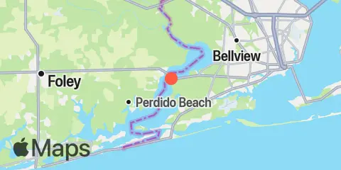
Location & Map
Latitude
30° 23' 13" N (30.38694)
Longitude
87° 25' 44" W (-87.42881)
State
County
Nearest ZIP
32506
Nearby
Tides
0.5 mi
Nix Point, Perdido Bay
4.8 mi
Millview, Perdido Bay
6.0 mi
Big Lagoon
7.6 mi
Mill Point, Arnica Bay
8.1 mi
Fort McRee Breakwater, Pensacola Bay
9.7 mi
Warrington, 2 miles south of, Pensacola Bay
10.4 mi
Wolf Bay
10.6 mi
Alabama Point, Perdido Pass
Currents
8.5 mi
Pensacola Bay entrance, midchannel
Note: Tide predictions are an estimate and NOT FOR NAVIGATION.
We also offer free widgets if you want to add tide or solunar tables to your own site.