Billys Point Tides & Fishing Times
Tides
Billys Point tide chart key:
The tide chart above shows the times and heights of high tide and low tide for Billys Point, as well as solunar period times (represented by fish icons). The red line highlights the current time and estimated height.| Day | Tide | Time | Height |
|---|---|---|---|
| 9 Fri | ▲ High | 1.48 ft | |
| 10 Sat | ▼ Low | 0.2 ft | |
| 10 Sat | ▲ High | 1.39 ft | |
| 10 Sat | ▼ Low | -0.02 ft | |
| 10 Sat | ▲ High | 1.52 ft | |
| 11 Sun | ▼ Low | 0.19 ft |
Saturday, May 10, 2025 11:48 PM: The tide is currently falling at Billys Point with a current estimated height of 1.4 ft. The last tide was High at 10:34 PM and the next tide is a Low of 0.19 ft at 5:33 AM. The tidal range today is approximately 1.54 ft with a minimum tide of -0.02 ft and maximum tide of 1.52 ft.
Next 7 Days
▲ Blue = High Tide
▼ Red = Low Tide
| Day | 1st Tide | 2nd Tide | 3rd Tide | 4th Tide | ☀ Sun |
Major Solunars
|
Minor Solunars
|
|
|---|---|---|---|---|---|---|---|---|
| 10 Sat |
|
▼ 0.2 ft |
▲ 1.39 ft |
▼ -0.02 ft |
▲ 1.52 ft |
▲ 6:38 AM ▼ 7:56 PM |
11:48 AM → 1:48 PM |
5:11 AM → 6:11 AM 6:25 PM → 7:25 PM |
| 11 Sun |
|
▼ 0.19 ft |
▲ 1.4 ft |
▼ -0.04 ft |
▲ 1.54 ft |
▲ 6:38 AM ▼ 7:57 PM |
12:07 AM → 2:07 AM 12:30 PM → 2:30 PM |
5:42 AM → 6:42 AM 7:18 PM → 8:18 PM |
| 12 Mon |
|
▼ 0.19 ft |
▲ 1.4 ft |
▼ -0.05 ft |
▲ 1.55 ft |
▲ 6:37 AM ▼ 7:57 PM |
12:50 AM → 2:50 AM 1:15 PM → 3:15 PM |
6:17 AM → 7:17 AM 8:13 PM → 9:13 PM |
| 13 Tue |
|
▼ 0.2 ft |
▲ 1.4 ft |
▼ -0.04 ft |
▲ 6:37 AM ▼ 7:58 PM |
1:36 AM → 3:36 AM 2:03 PM → 4:03 PM |
6:55 AM → 7:55 AM 9:11 PM → 10:11 PM |
|
| 14 Wed |
|
▲ 1.54 ft |
▼ 0.22 ft |
▲ 1.38 ft |
▼ -0.03 ft |
▲ 6:36 AM ▼ 7:59 PM |
2:26 AM → 4:26 AM 2:53 PM → 4:53 PM |
7:39 AM → 8:39 AM 10:07 PM → 11:07 PM |
| 15 Thu |
|
▲ 1.51 ft |
▼ 0.25 ft |
▲ 1.35 ft |
▼ 0 ft |
▲ 6:36 AM ▼ 7:59 PM |
3:18 AM → 5:18 AM 3:45 PM → 5:45 PM |
8:29 AM → 9:29 AM 11:01 PM → 12:01 AM |
| 16 Fri |
|
▲ 1.47 ft |
▼ 0.28 ft |
▲ 1.32 ft |
▼ 0.03 ft |
▲ 6:35 AM ▼ 8:00 PM |
4:11 AM → 6:11 AM 4:37 PM → 6:37 PM |
9:24 AM → 10:24 AM 11:51 PM → 12:51 AM |
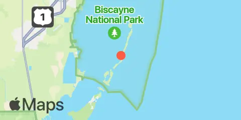
Location & Map
Latitude
25° 24' 54" N (25.415)
Longitude
80° 12' 36" W (-80.21)
State
County
Nearby
Tides
1.9 mi
Adams Key, South End, Biscayne Bay
2.0 mi
Christmas Point, Elliott Key
2.8 mi
Elliott Key Harbor, Elliott Key, Biscayne Bay
3.9 mi
Totten Key, west side, Biscayne Bay
4.7 mi
Sea Grape Point, Elliott Key
4.7 mi
Coon Point, Elliott Key, Biscayne Bay
5.8 mi
East Arsenicker, Card Sound
6.5 mi
Sands Key, northwest point, Biscayne Bay
7.6 mi
Turkey Point, Biscayne Bay
7.8 mi
Ragged Key No. 5, Biscayne Bay
8.1 mi
Pumpkin Key, South End, Card Sound
8.5 mi
Ocean Reef Harbor, Key Largo
8.5 mi
Ragged Keys, Biscayne Bay
9.0 mi
Card Sound, western side
9.1 mi
Wednesday Point, Key Largo, Card Sound
11.9 mi
Cormorant Point, Key Largo, Card Sound
Currents
2.2 mi
Caesar Creek, Biscayne Bay
Note: Tide predictions are an estimate and NOT FOR NAVIGATION.
We also offer free widgets if you want to add tide or solunar tables to your own site.