Murderkill River Entrance Weekly Tide Tables and Charts
Tide Chart for Next 7 Days
Murderkill River Entrance weekly tide chart key:
The tide chart above shows the times and heights of high tide and low tide for Murderkill River Entrance, for the next seven days. The red line highlights the current time and estimated height.The tidal range at Murderkill River Entrance for the next seven days is approximately 5.59 ft with a minimum tide of 0.08 ft and maximum tide of 5.67 ft. You can also check out all the daily details on tides & fishing times on the Day tab for Murderkill River Entrance.
Tide Table for Next 7 Days
▲ Blue = High Tide
▼ Red = Low Tide
| Day | 1st Tide | 2nd Tide | 3rd Tide | 4th Tide | ☀ Sun |
Major Solunars
|
Minor Solunars
|
|
|---|---|---|---|---|---|---|---|---|
| 13 Sun |
|
▼ 0.08 ft |
▲ 4.87 ft |
▼ 0.2 ft |
▲ 5.65 ft |
▲ 6:27 AM ▼ 7:37 PM |
1:06 AM → 3:06 AM 1:31 PM → 3:31 PM |
6:30 AM → 7:30 AM 8:32 PM → 9:32 PM |
| 14 Mon |
|
▼ 0.12 ft |
▲ 4.71 ft |
▼ 0.26 ft |
▲ 5.67 ft |
▲ 6:26 AM ▼ 7:38 PM |
1:48 AM → 3:48 AM 2:15 PM → 4:15 PM |
6:54 AM → 7:54 AM 9:36 PM → 10:36 PM |
| 15 Tue |
|
▼ 0.21 ft |
▲ 4.52 ft |
▼ 0.35 ft |
▲ 5.62 ft |
▲ 6:24 AM ▼ 7:39 PM |
2:32 AM → 4:32 AM 3:00 PM → 5:00 PM |
7:22 AM → 8:22 AM 10:39 PM → 11:39 PM |
| 16 Wed |
|
▼ 0.34 ft |
▲ 4.3 ft |
▼ 0.46 ft |
▲ 6:23 AM ▼ 7:40 PM |
3:19 AM → 5:19 AM 3:48 PM → 5:48 PM |
7:56 AM → 8:56 AM 11:40 PM → 12:40 AM |
|
| 17 Thu |
|
▲ 5.52 ft |
▼ 0.48 ft |
▲ 4.1 ft |
▼ 0.58 ft |
▲ 6:22 AM ▼ 7:41 PM |
4:09 AM → 6:09 AM 4:37 PM → 6:37 PM |
8:37 AM → 9:37 AM |
| 18 Fri |
|
▲ 5.4 ft |
▼ 0.62 ft |
▲ 3.94 ft |
▼ 0.68 ft |
▲ 6:20 AM ▼ 7:42 PM |
5:02 AM → 7:02 AM 5:28 PM → 7:28 PM |
12:38 AM → 1:38 AM 9:26 AM → 10:26 AM |
| 19 Sat |
|
▲ 5.28 ft |
▼ 0.71 ft |
▲ 3.84 ft |
▼ 0.75 ft |
▲ 6:19 AM ▼ 7:43 PM |
5:56 AM → 7:56 AM 6:20 PM → 8:20 PM |
1:31 AM → 2:31 AM 10:24 AM → 11:24 AM |
Buoy Weather
Air Temperature
50.2° F
Wind
8 knots NW (320°)
Atmospheric Pressure
29.97 in
Note: Observations are from a weather buoy 3.03 miles from the prediction site. Observations are not available at all prediction sites, and observation types vary between sites.
More details: Station drsd1 Buoy Weather
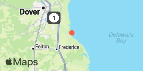
Location & Map
Latitude
39° 3' 30" N (39.0583)
Longitude
75° 23' 48" W (-75.3967)
State
County
Nearest ZIP
19946
Nearby
Tides
8.8 mi
Mahon River entrance, Delaware Bay
9.0 mi
Mispillion River entrance, Delaware Bay
Currents
0.9 mi
St. Jones River ent., 1 mile east of
7.0 mi
Big Stone Beach, 2.2 n.mi. ENE of
8.5 mi
Big Stone Beach, 2.8 miles southeast of
8.9 mi
Mispillion River mouth
10.5 mi
Cross Ledge Light
10.9 mi
Kelly Island, 1.5 miles east of
11.2 mi
Brandywine Range at Miah Maull Range
Note: Tide predictions are an estimate and NOT FOR NAVIGATION.
We also offer free widgets if you want to add tide or solunar tables to your own site.