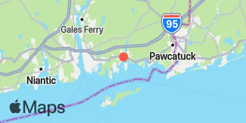
TidesPro
  • Recents
    • West Mystic, Mystic River, Long Island Sound
  • Tides
    United States
    Alabama Alaska California Connecticut Delaware District of Columbia Florida Georgia Hawaii
    Louisiana Maine Maryland Massachusetts Mississippi New Hampshire New Jersey New York North Carolina
    Oregon Pennsylvania Rhode Island South Carolina Texas US Outlying Islands Virginia Washington Puerto Rico
    Caribbean
    The Bahamas Cayman Islands Cuba Dominican Republic Haiti Jamaica Virgin Islands (US)
  • Fishing  Coordinates
    Alabama - Alabama Inshore Public Reefs Alabama - Alabama Nearshore Public Reefs Alabama - Alabama Offshore Public Reefs California - California Artificial Reefs Delaware - Delaware Artificial Reefs Florida - Bay County Florida - Brevard County Florida - Broward County Florida - Charlote and Lee Counties Florida - Citrus County Florida - Collier County Florida - Dixie County Florida - Duval County Florida - Escambia County Florida - Flagler County Florida - Florida Keys Florida - Franklin County Florida - Gulf County Florida - Hernando County
    Florida - Indian River County Florida - Levy County Florida - Manatee County Florida - Martin County Florida - Miami-Dade County Florida - Monroe County Florida - Nassau County Florida - Okaloosa County Florida - Palm Beach County Florida - Pasco County Florida - Santa Rosa County Florida - Sarasota County Florida - St. Johns County Florida - St. Lucie County Florida - Tampa Bay Florida - Taylor County Florida - Volusia County Florida - Wakulla County Florida - Walton County
    Georgia - Georgia Reefs Hawaii - Hawaii Artificial Reefs Louisiana - Louisiana Artificial Reefs Maryland - Maryland Artificial Reefs Massachusetts - Massachusetts Artificial Reefs Mississippi - Mississippi Inshore Artificial Reefs Mississippi - Mississippi Offshore Artificial Reefs New Jersey - New Jersey Artificial Reefs New York - New York Artificial Reefs North Carolina - Estuarine North Carolina - Long Bay North Carolina - Onslow Bay North Carolina - Outer Banks North Carolina - Raleigh Bay Puerto Rico - Puerto Rico Artificial Reefs Rhode Island - Rhode Island Artificial Reefs South Carolina - South Carolina Reefs Texas - Texas Artificial Reefs Virginia - Virginia Artificial Reefs
  • Solunar Tables
West Mystic Location
  1. United States
  2. Connecticut
  3. West Mystic, Mystic River, Long Island Sound

West Mystic Map

Day Week Month Table Month Chart Map
Latitude
41° 20' 36" N (41.3433)
Longitude
71° 58' 30" W (-71.975)
State
Connecticut
County
New London County
Nearest ZIP
06340
Nearby
Tides 6.1 mi New London, Thames River 6.5 mi Watch Hill Point 6.6 mi Silver Eel Pond, Fishers Island 7.9 mi Westerly, Pawcatuck River 8.6 mi Yale boathouse, Thames River 11.1 mi Niantic, Niantic River 11.1 mi Weekapaug Point, Block Island Sound 11.5 mi Little Gull Island, Long Island Currents 2.9 mi Ram Island Reef, south of 3.1 mi Clay Point, 1.3 miles NNE of 4.4 mi North Hill Point, 1.1 miles NNW of 4.8 mi Little Narragansett Bay entrance 4.9 mi Wicopesset island, NE of 5.0 mi Napatree Point, 0.7 mile southwest of 5.8 mi Fort Trumbull State Park 5.8 mi New London Harbor entrance 5.9 mi New London State Pier 6.3 mi U.S. Coast Guard Academy 6.4 mi Thames River Approach 6.8 mi Mt. Prospect, 0.6 mile SSE of 6.9 mi Groton, Thames River, Pier 6 7.3 mi Smith Cove 7.7 mi Race Point, 0.4 mile southwest of 8.6 mi Goshen Point, 1.9 miles SSE of 8.7 mi East Pt., 4.1 miles S of Fishers Island 8.8 mi Cerberus Shoal and Fishers I., between 9.0 mi Allyn Point 9.0 mi Watch Hill Point, 2.2 miles east of 9.2 mi The Race 9.2 mi Twotree Island Channel 9.8 mi Bartlett Reef, 0.2 mile south of 10.2 mi Little Gull Island, 1.4 n.mi. NNE of 10.4 mi Little Gull Island, 1.1 miles ENE of 10.5 mi Niantic (Railroad Bridge) 11.3 mi Little Gull Island, 0.8 mile NNW of 11.8 mi Watch Hill Point, 5.2 miles SSE of 12.0 mi Cerberus Shoal, 1.5 miles east of

About

TidesPro was created as an easy-to-use tides and solunar site. It provides tide predictions and marine weather for many types of people, whether you’re fishing, going to the beach, boating, kayaking, surfing, or planning a trip. With anglers in mind, it also provides an accessible way to find fishing spots and the best times to fish in those locations.

More About TidesPro

App

Apple App Store
[More Info]
Quick Links
  • When to Fish
  • Solunar Theory
  • Tide & Solunar Widgets for Your Site
  • Tide & Solunar Predictions in Google Earth
  • Things to Do
  • About

© Copyright 2017 - 2025 ASR Concepts LLC. All rights reserved.

  • Privacy Policy
  • •
  • Terms of Use
  • •
  • Contact
  • •
  • Bluesky
  • •
  • Mastodon