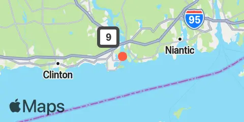
Saybrook Point Map
Latitude
41° 16' 60" N (41.2833)
Longitude
72° 21' 0" W (-72.35)
State
County
Nearest ZIP
06475
Nearby
Tides
1.4 mi
Saybrook Jetty, Connecticut River
2.7 mi
Lyme, highway bridge, Connecticut River
4.8 mi
Essex, Connecticut River
6.5 mi
Westbrook, Duck Island Roads
9.0 mi
Niantic, Niantic River
9.5 mi
Clinton Harbor
10.3 mi
Hadlyme, Connecticut River
10.4 mi
Orient Harbor, Orient, Shelter Island Sound
10.8 mi
Plum Gut Harbor, Plum Island, Long Island
Currents
0.1 mi
Saybrook Channel
1.8 mi
Saybrook Breakwater Light
2.4 mi
I-95 Bridge
3.1 mi
Saybrook Breakwater, 1.5 miles SE of
3.4 mi
Cornfield Point, 1.1 miles south of
3.6 mi
Cornfield Point, 2.8 n.mi. SE of
3.6 mi
Hatchett Point, 1.1 miles WSW of
4.7 mi
Cornfield Point, 1.9 n.mi. SW of
5.2 mi
Hatchett Point, 1.6 n.mi. S of
6.0 mi
Mulford Point, 3.1 miles northwest of
6.6 mi
Cornfield Point, 4 miles south of, Buoy CF
6.9 mi
Kelsey Point, 2.1 miles southeast of
7.4 mi
Black Point, 0.8 mile south of
7.8 mi
Eustasia Island, 0.6 mile ESE of
8.3 mi
Black Point and Plum Island, between
8.4 mi
Six Mile Reef, 1.5 miles north of
8.5 mi
Kelsey Point, 1 mile south of
8.8 mi
Six Mile Reef, 2 miles east of
9.5 mi
Niantic (Railroad Bridge)
9.6 mi
Orient Point, 1 mile WNW of
9.7 mi
Rocky Point, 0.3 mile north of
9.8 mi
Plum Island, 0.8 mile NNW of
9.9 mi
Plum Island, 3nm. North of, Buoy PI
10.9 mi
Twotree Island Channel
11.1 mi
Six mile Reef, 1 mile south of
11.3 mi
Bartlett Reef, 0.2 mile south of
11.3 mi
Plum Gut
11.7 mi
Hammonasset Point, 1.2 miles SW of