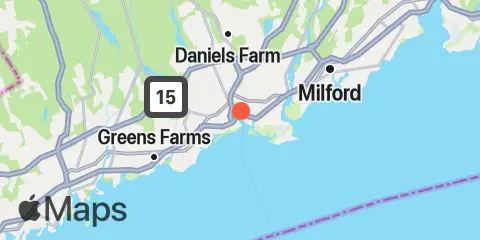
Latitude
41° 10' 33" N (41.17581944444444)
Longitude
73° 11' 2" W (-73.18396944444444)
State
County
Nearest ZIP
06608
Nearby
Tides
2.0 mi
Black Rock Harbor, Cedar Creek
3.8 mi
Sniffens Point, Housatonic River
4.2 mi
Stratford, I-95 bridge, Housatonic River
5.9 mi
Southport, Southport Harbor
7.3 mi
Milford Harbor
7.7 mi
Gulf Beach
8.5 mi
Long Hill, Housatonic River
10.3 mi
Saugatuck, Saugatuck River, Long Island Sound
10.5 mi
Shelton, Housatonic River
Currents
0.8 mi
Bridgeport Harbor, Tongue Point
3.7 mi
Milford Point, 0.2 mile west of
3.8 mi
Bridgeport Harbor Entrance
4.4 mi
Railroad drawbridge, above
5.5 mi
Point No Point, 2.1 miles south of
6.1 mi
Fowler Island, 0.1 mile NNW of
7.0 mi
Pine Creek Point, 2.3 miles SSE of
7.2 mi
Stratford Point, 3.5 miles south of
7.3 mi
Charles Island, 0.8 mile SSE of
7.7 mi
Stratford Point, 4.3 miles south of
8.7 mi
Wooster Island, 0.1 mile southwest of
9.8 mi
Stratford Point, 6.1 miles south of
10.5 mi
Shoal Point, 6 miles south of
10.7 mi
Saugatuck River, 0.3 mi. NW of Bluff Pt
10.9 mi
Old Field Point, 2.9 n.mi. NNW of
11.3 mi
Stratford Shoal, 2 miles south of
11.5 mi
Pond Point, 4.2 miles SSE of
