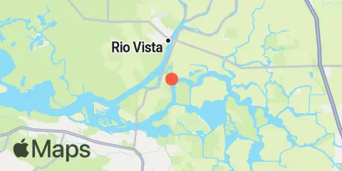
Latitude
38° 5' 12" N (38.0867)
Longitude
121° 41' 6" W (-121.685)
State
County
Nearest ZIP
94571
Nearby
Tides
1.6 mi
Threemile Slough, Sacramento River
2.7 mi
False River, San Joaquin River
4.0 mi
Rio Vista, Sacramento River
5.8 mi
Davis Slough, San Joaquin River
6.4 mi
Korths Harbor, San Joaquin River
6.4 mi
Georgiana Slough entrance, Mokelumne River
6.7 mi
Irish Landing, Sand Mound Slough, San Joaquin River
6.9 mi
Steamboat Slough, Snug Harbor Marina, Sacramento River
7.3 mi
Prisoners Point, San Joaquin River
8.4 mi
Antioch, San Joaquin River
8.9 mi
Collinsville, Sacramento River
10.3 mi
Terminous, South Fork, Mokelumne River
10.6 mi
Wards Island, Little Connection Slough, San Joaquin River
10.9 mi
Montezuma Slough, Suisun Bay
11.2 mi
Pittsburg, New York Slough, Suisun Bay
12.3 mi
Orwood, Old River, San Joaquin River
Currents
4.3 mi
Sacramento River Light 14
5.5 mi
Antioch, Route 160 bridge
6.2 mi
West Island Lt., 0.5 mile SE of
6.8 mi
Sherman Island East, 0.2 mile north of
7.1 mi
West Island, north of
8.1 mi
Antioch Point, 0.3 mile east of
8.2 mi
Point Sacramento, 0.3 mile NE OF
8.2 mi
Point Sacramento, 0.2nm NE of
8.7 mi
Antioch Point
8.9 mi
Point Beenar, 0.7 nmi. north of
9.0 mi
Point Beenar, 100 yds., NE of
9.1 mi
Pt. San Joaquin, 0.45 nmi. ENE of
9.7 mi
New York Slough, Winter Island
10.3 mi
Entrance, 0.7 mile SW of Chain Island
10.3 mi
Entrance, 0.7nm SW of Chain Island
10.7 mi
New York Slough, 0.6miles E of Pt. Emmet
10.7 mi
New York Slough, 0.6miles E of Pt. Emmet
10.8 mi
Montezuma Slough, east end, near bridge
12.1 mi
Spoonbill Creek, near bridge
