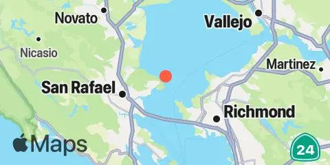
Point San Pedro Map
Latitude
37° 59' 36" N (37.9933)
Longitude
122° 26' 49" W (-122.447)
State
County
Nearest ZIP
94901
Nearby
Tides
2.7 mi
Point Orient, San Francisco Bay
3.4 mi
Gallinas, Gallinas Creek, San Pablo Bay
3.7 mi
Point San Quentin, San Francisco Bay
4.8 mi
Pinole Point, San Pablo Bay
5.0 mi
Corte Madera Creek, San Francisco Bay
5.2 mi
Richmond, San Francisco Bay
7.0 mi
Point Chauncey, San Francisco Bay
7.5 mi
Richmond Inner Harbor, San Francisco Bay
8.7 mi
Hercules, Refugio Landing, San Pablo Bay
9.0 mi
Petaluma River entrance, San Pablo Bay
9.1 mi
Angel Island, East Garrison, San Francisco Bay
9.2 mi
Sausalito, Corps of Engineers Dock, San Francisco Bay
9.2 mi
Angel Island (west side), San Francisco Bay
9.5 mi
Point Isabel, San Francisco Bay
10.3 mi
Sausalito, San Francisco Bay
11.5 mi
Sonoma Creek, San Pablo Bay
11.6 mi
Alcatraz Island, San Francisco Bay
11.7 mi
Berkeley, San Francisco Bay
12.0 mi
Mare Island Naval Shipyard, Carquinez Strait
12.0 mi
Selby
Currents
1.1 mi
Point San Pedro, 0.55 nmi. SE of
1.7 mi
Point San Pablo, midchannel
2.6 mi
Pinole Point, 3.0 nmi. WNW of
3.0 mi
Point San Quentin, 1.9 miles east of
3.3 mi
Pinole Point, 1.18 nmi. west of
3.5 mi
Point San Quentin, 1.3 nmi. east of
3.6 mi
Petaluma River approach (Buoys 3 and 4)
3.7 mi
Point San Quentin, 0.82 nmi. east of
3.8 mi
Red Rock, 0.60 nmi. NNE of
4.5 mi
Red Rock, east of
4.6 mi
Richmond
4.6 mi
Pinole Point, 1.27 nmi. NNW of
4.6 mi
Pinole Point, 1.42 nmi. NNW of
5.4 mi
Point Chauncey, 1.25 nm north of
5.5 mi
Southampton Shoal Channel, LB 6
5.5 mi
Petaluma River approach
5.7 mi
Point Richmond, 0.8 nmi. NNW of
6.3 mi
Point Chauncey, 0.75 nmi. NW of
6.6 mi
Point Richmond, 0.5 mile west of
7.2 mi
Pinole Shoal
7.3 mi
Point Chauncey, 1.3 miles east of
7.6 mi
Bluff Point, 1.15 nmi. east of
7.6 mi
Bluff Point, 0.1 mile east of
8.0 mi
Wilson Point, 3.90 nmi. NNW of
8.2 mi
Southampton Shoal Light, 0.2 mile E of
8.4 mi
Raccoon Strait
8.5 mi
Petaluma River entrance
8.6 mi
Point Simpson, Angel I., 1.05 nmi. E of
9.1 mi
Raccoon Strait, off Point Stuart
9.2 mi
Angel Island, off Quarry Point
9.3 mi
Angel Island, 0.75 mile east of
9.4 mi
Fleming Point, 1.72 nmi. SW of
9.9 mi
Pt. Blunt, Angel I., 0.25 nmi. east of
10.2 mi
Yellow Bluff, 0.8 nmi. NE of
10.3 mi
Point Blunt, Angel I., 0.25 mile S of
10.3 mi
Point Blunt, Angel I., 0.5 nmi. SW of
10.4 mi
Davis Point, 1.0 nmi. NW of
10.5 mi
Pt. Blunt, Angel I., 0.8 mi. SE of
11.0 mi
Yellow Bluff, 0.8 mile east of
11.0 mi
Alcatraz Island, 0.5 mile north of
11.2 mi
Point Cavallo, 1.3 miles east of
11.3 mi
Treasure Island, 0.78 NM NW of
11.4 mi
Davis Point, (midchannel)
11.4 mi
Golden Gate Bridge, 0.88 nm NE of
11.4 mi
Treasure Island, 0.5 mile north of
11.5 mi
Alcatraz Island, 0.2 mile west of
11.9 mi
Golden Gate Bridge, 0.8 mile east of
12.1 mi
Golden Gate Bridge, 0.46 nm E of
12.2 mi
Alcatraz Island, south of
12.2 mi
Treasure Island, 0.8 mile west of
12.3 mi
Emeryville Marina
12.4 mi
Mare Island Strait, NE of Pier 34
12.4 mi
Alcatraz Island, southwest of