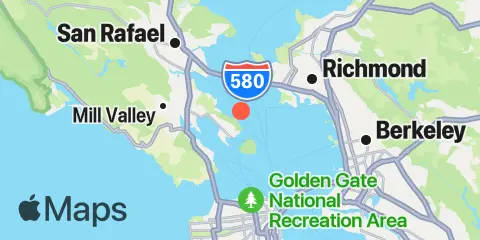
Point Chauncey Map
Latitude
37° 53' 30" N (37.8917)
Longitude
122° 26' 35" W (-122.443)
State
County
Nearest ZIP
94920
Nearby
Tides
2.2 mi
Angel Island (west side), San Francisco Bay
2.3 mi
Angel Island, East Garrison, San Francisco Bay
3.3 mi
Sausalito, Corps of Engineers Dock, San Francisco Bay
3.5 mi
Richmond, San Francisco Bay
3.6 mi
Sausalito, San Francisco Bay
4.1 mi
Point San Quentin, San Francisco Bay
4.7 mi
Point Orient, San Francisco Bay
4.7 mi
Alcatraz Island, San Francisco Bay
4.8 mi
Richmond Inner Harbor, San Francisco Bay
5.2 mi
Corte Madera Creek, San Francisco Bay
5.9 mi
North Point, Pier 41, San Francisco, San Francisco Bay
6.0 mi
San Francisco, San Francisco Bay
6.7 mi
Point Isabel, San Francisco Bay
6.9 mi
Point Bonita, Bonita Cove, San Francisco Bay
7.0 mi
Point San Pedro, San Pablo Bay
7.2 mi
Yerba Buena Island, San Francisco Bay
7.6 mi
Berkeley, San Francisco Bay
7.7 mi
Rincon Point, Pier 22½, San Francisco Bay
8.3 mi
Oakland Middle Harbor, San Francisco Bay
8.5 mi
Oakland, Matson Wharf, San Francisco Bay
8.9 mi
Ocean Beach, outer coast
9.1 mi
Oakland Pier, San Francisco Bay
9.1 mi
Gallinas, Gallinas Creek, San Pablo Bay
9.6 mi
Pinole Point, San Pablo Bay
9.8 mi
Alameda Naval Air Station fuel pier, San Francisco Bay
9.8 mi
Potrero Point, San Francisco Bay
11.0 mi
Oakland Berth 67, San Francisco Bay
11.0 mi
Oakland Inner Harbor, San Francisco Bay
11.4 mi
Alameda, San Francisco Bay
12.1 mi
Hunters Point, San Francisco Bay
12.3 mi
Hercules, Refugio Landing, San Pablo Bay
Currents
0.7 mi
Bluff Point, 0.1 mile east of
1.2 mi
Point Chauncey, 0.75 nmi. NW of
1.3 mi
Point Chauncey, 1.3 miles east of
1.4 mi
Raccoon Strait
1.6 mi
Point Chauncey, 1.25 nm north of
1.7 mi
Bluff Point, 1.15 nmi. east of
2.0 mi
Southampton Shoal Channel, LB 6
2.2 mi
Raccoon Strait, off Point Stuart
2.5 mi
Point Simpson, Angel I., 1.05 nmi. E of
2.5 mi
Point Richmond, 0.5 mile west of
2.5 mi
Angel Island, off Quarry Point
2.7 mi
Southampton Shoal Light, 0.2 mile E of
2.7 mi
Red Rock, east of
2.8 mi
Richmond
3.0 mi
Angel Island, 0.75 mile east of
3.2 mi
Pt. Blunt, Angel I., 0.25 nmi. east of
3.2 mi
Point Richmond, 0.8 nmi. NNW of
3.3 mi
Yellow Bluff, 0.8 nmi. NE of
3.4 mi
Point Blunt, Angel I., 0.5 nmi. SW of
3.4 mi
Point Blunt, Angel I., 0.25 mile S of
3.5 mi
Red Rock, 0.60 nmi. NNE of
3.5 mi
Point San Quentin, 1.3 nmi. east of
3.6 mi
Point San Quentin, 0.82 nmi. east of
3.8 mi
Pt. Blunt, Angel I., 0.8 mi. SE of
4.0 mi
Yellow Bluff, 0.8 mile east of
4.0 mi
Point San Quentin, 1.9 miles east of
4.1 mi
Alcatraz Island, 0.5 mile north of
4.2 mi
Point Cavallo, 1.3 miles east of
4.4 mi
Golden Gate Bridge, 0.88 nm NE of
4.5 mi
Alcatraz Island, 0.2 mile west of
4.7 mi
Fleming Point, 1.72 nmi. SW of
4.8 mi
Treasure Island, 0.78 NM NW of
4.9 mi
Golden Gate Bridge, 0.8 mile east of
5.2 mi
Alcatraz Island, south of
5.2 mi
Golden Gate Bridge, 0.46 nm E of
5.3 mi
Point San Pablo, midchannel
5.4 mi
Alcatraz Island, southwest of
5.4 mi
Treasure Island, 0.5 mile north of
5.6 mi
Treasure Island, 0.8 mile west of
5.7 mi
Fort Point, 0.5 nmi. east of
5.7 mi
North Point, Pier 35, north of
5.9 mi
Point Diablo, 0.2 mile SE of
6.0 mi
Treasure Island, 0.2 mile west of
6.1 mi
Point San Pedro, 0.55 nmi. SE of
6.1 mi
Fort Point, 0.3 nmi. west of
6.3 mi
Point Bonita, 0.8 nmi. NE of
6.5 mi
San Francisco Bay Entrance (Outside)
6.5 mi
Pier 23
6.5 mi
Yerba Buena Island, west of (midchannel)
6.6 mi
Treasure Island, 0.3 mile east of
7.0 mi
Baker Beach (South Bay), 0.3 nmi. NW of
7.0 mi
Point Bonita Lt., 0.4 nmi. SSE of
7.0 mi
Treasure Island, 0.85 nmi. east of
7.2 mi
Emeryville Marina
7.3 mi
Bay Bridge, Pier D
7.5 mi
Point Bonita, 0.95 nm SSE of
7.5 mi
Bay Bridge, Span B-C
7.6 mi
Oakland, Yerba Buena Island
7.6 mi
Mile Rock Lt., 0.2 nmi. NW of
7.7 mi
Yerba Buena Island, 0.3 nmi. SE of
7.9 mi
Oakland Outer Harbor Entrance, LB 3
8.0 mi
Rincon Point
8.1 mi
Oakland Inner Harbor LB4
8.4 mi
Oakland Inner Harbor entrance
8.6 mi
Pinole Point, 1.18 nmi. west of
8.6 mi
Oakland 7th St. Marine, 0.6 nmi. SSW of
8.9 mi
Rincon Point, midbay
9.1 mi
Mission Rock, 0.6 mile east of
9.4 mi
Pinole Point, 3.0 nmi. WNW of
9.4 mi
Mission Rock, 1.3 mile east of
9.5 mi
Oakland Inner Harbor Channel
9.7 mi
Point Lobos, 1.3 nmi. SW of
9.8 mi
Mission Rock, 2.0 miles east of
10.3 mi
Pinole Point, 1.27 nmi. NNW of
10.4 mi
Potrero Point, 1.08 nmi. east of
10.4 mi
Pinole Point, 1.42 nmi. NNW of
10.5 mi
Petaluma River approach (Buoys 3 and 4)
10.7 mi
Point Lobos, 3.73 nmi. W of
11.0 mi
South Channel
11.0 mi
Oakland Inner Harbor Reach
11.5 mi
Potrero Point, 2 miles east of
11.5 mi
Oakland Harbor, Webster Street
11.9 mi
San Francisco Bar, north of ship channel
12.3 mi
Point Bonita Lt., 5.27 nmi. WSW of
12.3 mi
Pinole Shoal
12.3 mi
Point Avisadero, 0.3 mile east of
12.4 mi
Brooklyn Basin
12.4 mi
Petaluma River approach