Point Bonita Weekly Tide Tables and Charts
Tide Chart for Next 7 Days
Point Bonita weekly tide chart key:
The tide chart above shows the times and heights of high tide and low tide for Point Bonita, for the next seven days. The red line highlights the current time and estimated height.The tidal range at Point Bonita for the next seven days is approximately 7.59 ft with a minimum tide of -0.83 ft and maximum tide of 6.76 ft. You can also check out all the daily details on tides & fishing times on the Day tab for Point Bonita.
Tide Table for Next 7 Days
▲ Blue = High Tide
▼ Red = Low Tide
| Day | 1st Tide | 2nd Tide | 3rd Tide | 4th Tide | ☀ Sun |
Major Solunars
|
Minor Solunars
|
|
|---|---|---|---|---|---|---|---|---|
| 26 Sat |
|
▲ 6.76 ft |
▼ -0.83 ft |
▲ 5.51 ft |
▼ 2.52 ft |
▲ 6:09 AM ▼ 8:24 PM |
2:44 AM → 4:44 AM 3:03 PM → 5:03 PM |
8:05 AM → 9:05 AM 9:51 PM → 10:51 PM |
| 27 Sun |
|
▲ 6.34 ft |
▼ -0.44 ft |
▲ 5.56 ft |
▼ 2.35 ft |
▲ 6:10 AM ▼ 8:23 PM |
3:30 AM → 5:30 AM 3:47 PM → 5:47 PM |
9:10 AM → 10:10 AM 10:15 PM → 11:15 PM |
| 28 Mon |
|
▲ 5.82 ft |
▼ 0.07 ft |
▲ 5.62 ft |
▼ 2.18 ft |
▲ 6:11 AM ▼ 8:22 PM |
4:13 AM → 6:13 AM 4:29 PM → 6:29 PM |
10:12 AM → 11:12 AM 10:36 PM → 11:36 PM |
| 29 Tue |
|
▲ 5.24 ft |
▼ 0.68 ft |
▲ 5.67 ft |
▼ 2 ft |
▲ 6:11 AM ▼ 8:21 PM |
4:54 AM → 6:54 AM 5:09 PM → 7:09 PM |
11:12 AM → 12:12 PM 10:58 PM → 11:58 PM |
| 30 Wed |
|
▲ 4.66 ft |
▼ 1.36 ft |
▲ 5.72 ft |
▼ 1.8 ft |
▲ 6:12 AM ▼ 8:20 PM |
5:34 AM → 7:34 AM 5:51 PM → 7:51 PM |
12:11 PM → 1:11 PM 11:20 PM → 12:20 AM |
| 31 Thu |
|
▲ 4.16 ft |
▼ 2.04 ft |
▲ 5.77 ft |
▼ 1.54 ft |
▲ 6:13 AM ▼ 8:19 PM |
6:15 AM → 8:15 AM 6:32 PM → 8:32 PM |
1:11 PM → 2:11 PM 11:45 PM → 12:45 AM |
| 1 Fri |
|
▲ 3.86 ft |
▼ 2.67 ft |
▲ 5.82 ft |
▲ 6:14 AM ▼ 8:18 PM |
6:58 AM → 8:58 AM 7:16 PM → 9:16 PM |
2:11 PM → 3:11 PM |
Buoy Weather
Air Temperature
56.5° F
Wind
1.9 knots WSW (240°)
Wind Gust
8.9 knots
Atmospheric Pressure
29.99 in
Note: Observations are from a weather buoy 3.49 miles from the prediction site. Observations are not available at all prediction sites, and observation types vary between sites.
More details: Station ftpc1 Buoy Weather
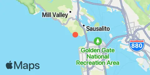
Location & Map
Latitude
37° 49' 6" N (37.8183)
Longitude
122° 31' 41" W (-122.528)
State
County
Nearest ZIP
94941
Nearby
Tides
3.1 mi
Ocean Beach, outer coast
3.4 mi
Sausalito, San Francisco Bay
3.5 mi
San Francisco, San Francisco Bay
3.8 mi
Sausalito, Corps of Engineers Dock, San Francisco Bay
5.5 mi
Angel Island (west side), San Francisco Bay
6.1 mi
Alcatraz Island, San Francisco Bay
6.3 mi
North Point, Pier 41, San Francisco, San Francisco Bay
6.7 mi
Angel Island, East Garrison, San Francisco Bay
6.8 mi
San Francisco Bar
6.9 mi
Point Chauncey, San Francisco Bay
7.9 mi
Rincon Point, Pier 22½, San Francisco Bay
8.7 mi
Corte Madera Creek, San Francisco Bay
8.9 mi
Potrero Point, San Francisco Bay
9.2 mi
Yerba Buena Island, San Francisco Bay
9.2 mi
Point San Quentin, San Francisco Bay
10.3 mi
Bolinas, Bolinas Lagoon
10.3 mi
Richmond, San Francisco Bay
10.4 mi
Oakland Middle Harbor, San Francisco Bay
10.9 mi
Oakland Pier, San Francisco Bay
11.0 mi
Oakland, Matson Wharf, San Francisco Bay
11.2 mi
Hunters Point, San Francisco Bay
11.2 mi
Point Orient, San Francisco Bay
11.2 mi
Richmond Inner Harbor, San Francisco Bay
11.8 mi
Alameda Naval Air Station fuel pier, San Francisco Bay
Currents
0.6 mi
Point Bonita Lt., 0.4 nmi. SSE of
0.7 mi
Point Bonita, 0.8 nmi. NE of
1.3 mi
Point Bonita, 0.95 nm SSE of
1.5 mi
San Francisco Bay Entrance (Outside)
1.7 mi
Point Diablo, 0.2 mile SE of
1.8 mi
Mile Rock Lt., 0.2 nmi. NW of
2.5 mi
Fort Point, 0.3 nmi. west of
2.6 mi
Baker Beach (South Bay), 0.3 nmi. NW of
3.0 mi
Golden Gate Bridge, 0.46 nm E of
3.3 mi
Point Lobos, 1.3 nmi. SW of
3.4 mi
Fort Point, 0.5 nmi. east of
3.6 mi
Golden Gate Bridge, 0.8 mile east of
3.7 mi
Golden Gate Bridge, 0.88 nm NE of
3.9 mi
Point Lobos, 3.73 nmi. W of
4.2 mi
Yellow Bluff, 0.8 mile east of
4.3 mi
Yellow Bluff, 0.8 nmi. NE of
4.7 mi
Point Cavallo, 1.3 miles east of
4.7 mi
South Channel
5.1 mi
Raccoon Strait, off Point Stuart
5.2 mi
San Francisco Bar, north of ship channel
5.3 mi
Alcatraz Island, southwest of
5.4 mi
Alcatraz Island, 0.2 mile west of
5.8 mi
Alcatraz Island, south of
6.0 mi
Raccoon Strait
6.0 mi
Alcatraz Island, 0.5 mile north of
6.0 mi
Point Blunt, Angel I., 0.5 nmi. SW of
6.1 mi
Point Bonita Lt., 5.27 nmi. WSW of
6.4 mi
Point Blunt, Angel I., 0.25 mile S of
6.6 mi
North Point, Pier 35, north of
6.8 mi
Pt. Blunt, Angel I., 0.25 nmi. east of
6.8 mi
Bluff Point, 0.1 mile east of
7.0 mi
Pt. Blunt, Angel I., 0.8 mi. SE of
7.0 mi
Point Chauncey, 0.75 nmi. NW of
7.0 mi
Angel Island, off Quarry Point
7.2 mi
Pier 23
7.5 mi
Treasure Island, 0.8 mile west of
7.6 mi
Angel Island, 0.75 mile east of
7.8 mi
Point Lobos, 5.47 nmi. SW of
7.8 mi
Point Chauncey, 1.3 miles east of
7.8 mi
Treasure Island, 0.78 NM NW of
7.8 mi
Point Simpson, Angel I., 1.05 nmi. E of
7.9 mi
Bluff Point, 1.15 nmi. east of
7.9 mi
Yerba Buena Island, west of (midchannel)
8.1 mi
Point Chauncey, 1.25 nm north of
8.2 mi
Treasure Island, 0.2 mile west of
8.5 mi
Southampton Shoal Light, 0.2 mile E of
8.5 mi
Bay Bridge, Pier D
8.5 mi
Bay Bridge, Span B-C
8.7 mi
Rincon Point
8.9 mi
Treasure Island, 0.5 mile north of
8.9 mi
Southampton Shoal Channel, LB 6
9.2 mi
Point Richmond, 0.5 mile west of
9.2 mi
Point San Quentin, 0.82 nmi. east of
9.3 mi
Mission Rock, 0.6 mile east of
9.4 mi
Yerba Buena Island, 0.3 nmi. SE of
9.4 mi
Red Rock, east of
9.5 mi
Treasure Island, 0.3 mile east of
9.5 mi
Point San Quentin, 1.3 nmi. east of
9.5 mi
Richmond
9.7 mi
Oakland, Yerba Buena Island
9.8 mi
Rincon Point, midbay
9.9 mi
Oakland Inner Harbor LB4
9.9 mi
Treasure Island, 0.85 nmi. east of
10.0 mi
Mission Rock, 1.3 mile east of
10.1 mi
Oakland Outer Harbor Entrance, LB 3
10.1 mi
Red Rock, 0.60 nmi. NNE of
10.1 mi
Point Richmond, 0.8 nmi. NNW of
10.1 mi
Fleming Point, 1.72 nmi. SW of
10.2 mi
Oakland 7th St. Marine, 0.6 nmi. SSW of
10.2 mi
Potrero Point, 1.08 nmi. east of
10.3 mi
Point San Quentin, 1.9 miles east of
10.3 mi
Oakland Inner Harbor entrance
10.5 mi
San Francisco traffic separation zone buoy
10.8 mi
Mission Rock, 2.0 miles east of
11.2 mi
Emeryville Marina
11.5 mi
Point San Pablo, midchannel
11.6 mi
Point Avisadero, 0.3 mile east of
11.6 mi
Oakland Inner Harbor Channel
11.6 mi
Potrero Point, 2 miles east of
12.1 mi
Point Avisadero, 1 mile east of
12.2 mi
Point San Pedro, 0.55 nmi. SE of
12.4 mi
Point Avisadero, 1.25 nmi. SSE of
Note: Tide predictions are an estimate and NOT FOR NAVIGATION.
We also offer free widgets if you want to add tide or solunar tables to your own site.