Unfortunately, this tide station is no longer active, and predictions are no longer accurate.
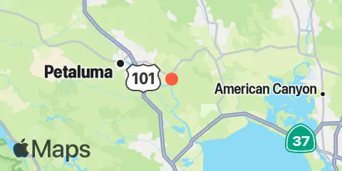
You can check out the map below -- any nearby locations will be displayed on the map and list below. Alternatively, you can browse the site for other active locations.
Location & Map
Latitude
38° 11' 54" N (38.1983)
Longitude
122° 32' 49" W (-122.547)
State
County
Nearest ZIP
94954
Nearby
Tides
1.1 mi
Lakeville, Petaluma River, San Pablo Bay
2.5 mi
Hog Island, San Antonio Creek, San Pablo Bay
4.1 mi
Upper drawbridge, Petaluma River, San Pablo Bay
6.2 mi
Petaluma River entrance, San Pablo Bay
6.6 mi
Wingo, Sonoma Creek, San Pablo Bay
8.1 mi
Sonoma Creek, San Pablo Bay
Currents
6.7 mi
Petaluma River entrance
11.2 mi
Petaluma River approach
