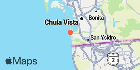
Latitude
32° 34' 42" N (32.5783)
Longitude
117° 8' 6" W (-117.135)
State
County
Nearest ZIP
91932
Nearby
Tides
3.9 mi
South San Diego Bay
6.1 mi
National City, San Diego Bay
8.4 mi
Point Loma
9.8 mi
San Diego, San Diego Bay
10.4 mi
San Diego, Quarantine Station
Currents
4.7 mi
Sweetwater Channel, southwest of
5.1 mi
National City
5.8 mi
National City, WSW of Pier 12
6.7 mi
28th St. Pier (San Diego), 0.92 nmi. SW
7.2 mi
28th St. Pier (San Diego), 0.35 nmi. SW
8.1 mi
Point Loma Light, 0.8 nmi. east of
8.4 mi
Coronado, off northeast end
9.0 mi
San Diego Bay Entrance
9.2 mi
Ballast Point, 100 yards north of
9.3 mi
Ballast Point, south of
9.3 mi
G St. Pier (San Diego), 0.22 nmi. SW of
9.9 mi
Ballast Point, 0.55 nmi. north of
10.0 mi
San Diego, 0.5 mile west of
10.2 mi
Quarantine Station, La Playa
10.3 mi
Harbor Island (east end), SSW of
10.4 mi
North Island
