Eureka Slough Bridge Weekly Tide Tables and Charts
Tide Chart for Next 7 Days
Eureka Slough Bridge weekly tide chart key:
The tide chart above shows the times and heights of high tide and low tide for Eureka Slough Bridge, for the next seven days. The red line highlights the current time and estimated height.The tidal range at Eureka Slough Bridge for the next seven days is approximately 10.72 ft with a minimum tide of -2.07 ft and maximum tide of 8.65 ft. You can also check out all the daily details on tides & fishing times on the Day tab for Eureka Slough Bridge.
Tide Table for Next 7 Days
▲ Blue = High Tide
▼ Red = Low Tide
| Day | 1st Tide | 2nd Tide | 3rd Tide | 4th Tide | ☀ Sun |
Major Solunars
|
Minor Solunars
|
|
|---|---|---|---|---|---|---|---|---|
| 25 Fri |
|
▼ 0.52 ft |
▲ 6.3 ft |
▼ 0.65 ft |
▲ 7.56 ft |
▲ 6:22 AM ▼ 8:07 PM |
11:23 AM → 1:23 PM 11:43 PM → 1:43 AM |
5:06 AM → 6:06 AM 5:54 PM → 6:54 PM |
| 26 Sat |
|
▼ -0.48 ft |
▲ 6.39 ft |
▼ 1.06 ft |
▲ 6:21 AM ▼ 8:08 PM | 12:14 PM → 2:14 PM |
5:31 AM → 6:31 AM 7:15 PM → 8:15 PM |
|
| 27 Sun |
|
▲ 8.12 ft |
▼ -1.31 ft |
▲ 6.39 ft |
▼ 1.53 ft |
▲ 6:20 AM ▼ 8:09 PM |
12:37 AM → 2:37 AM 1:09 PM → 3:09 PM |
5:59 AM → 6:59 AM 8:37 PM → 9:37 PM |
| 28 Mon |
|
▲ 8.51 ft |
▼ -1.86 ft |
▲ 6.3 ft |
▼ 2.01 ft |
▲ 6:18 AM ▼ 8:10 PM |
1:35 AM → 3:35 AM 2:08 PM → 4:08 PM |
6:33 AM → 7:33 AM 10:00 PM → 11:00 PM |
| 29 Tue |
|
▲ 8.65 ft |
▼ -2.07 ft |
▲ 6.11 ft |
▼ 2.46 ft |
▲ 6:17 AM ▼ 8:11 PM |
2:37 AM → 4:37 AM 3:11 PM → 5:11 PM |
7:15 AM → 8:15 AM 11:19 PM → 12:19 AM |
| 30 Wed |
|
▲ 8.53 ft |
▼ -1.98 ft |
▲ 5.87 ft |
▼ 2.84 ft |
▲ 6:16 AM ▼ 8:12 PM |
3:43 AM → 5:43 AM 4:15 PM → 6:15 PM |
8:08 AM → 9:08 AM |
| 1 Thu |
|
▲ 8.15 ft |
▼ -1.63 ft |
▲ 5.64 ft |
▼ 3.15 ft |
▲ 6:14 AM ▼ 8:13 PM |
4:50 AM → 6:50 AM 5:19 PM → 7:19 PM |
12:29 AM → 1:29 AM 9:11 AM → 10:11 AM |
Buoy Weather
Water Temperature
53.4° F
Note: Observations are from a weather buoy 3.54 miles from the prediction site. Observations are not available at all prediction sites, and observation types vary between sites.
More details: Station hbxc1 Buoy Weather
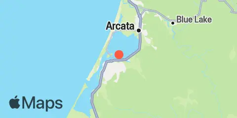
Location & Map
Latitude
40° 48' 24" N (40.8067)
Longitude
124° 8' 31" W (-124.142)
State
County
Nearest ZIP
95501
Nearby
Tides
1.3 mi
Eureka, Humboldt Bay
2.4 mi
Samoa, Humboldt Bay
3.3 mi
Arcata Wharf, Humboldt Bay
3.5 mi
Bucksport, Humboldt Bay
4.0 mi
Mad River Slough, Arcata Bay, Humboldt Bay
4.4 mi
Elk River Railroad Bridge, Humboldt Bay
4.8 mi
North Spit, Humboldt Bay
7.1 mi
Fields Landing, Humboldt Bay
9.3 mi
Hookton Slough, Humboldt Bay
Currents
2.5 mi
North Bay Channel at Samoa Channel
3.0 mi
North Bay Channel, west of Eureka
3.0 mi
North Bay Channel at Fairhaven
3.5 mi
North Bay Channel, Chevron Pier
5.5 mi
Humboldt Bay Entrance Channel LB 9
5.8 mi
Humboldt Bay Entrance Channel
5.8 mi
Humboldt Bay Entr., 0.1nm NE of South Spit Light
5.9 mi
South Spit, 0.1 n.mi. E of
6.1 mi
Hookton Channel Day Marker 3
6.4 mi
Humboldy Bay Bar Channel, 0.4 nm WNW of
Note: Tide predictions are an estimate and NOT FOR NAVIGATION.
We also offer free widgets if you want to add tide or solunar tables to your own site.